Friday, July 5 - The 05:00 sea conditions report gave us 15 kn NW with a 2 ft chop at Chatham Point (where Discovery Channel becomes Johnstone Strait) on a ebb tide (against the wind). The wind will increase to 30-35 late in the day. Given that we have several exit points west of Chatham we decided to go for it. Our intention is to get to Forward Harbor from which we can make the final leg up Johnstone tomorrow. If it gets awful before Chatham we can turn around and go back to Brown's Bay or continue south, back through Seymour, on the morning slack and go up the inside route through the rapids.
 |
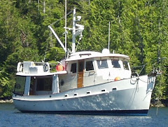
| Brown's Bay to Sullivan Bay |
We debated, for a while, whether or not to turn up Mayne or continue up Johnstone to Chancellor Channel. Timing the rapids was the issue. The slack water arrives first at Whirlpool, the northern most rapid, then about 40 minutes later it shows up at Shell Point, the southern most. But it takes us 2.5 hours to get from Shell Point to Whirlpool so we can not make both rapids at slack. We have to pull up after Shell Point and wait for a few hours then catch the afternoon slack at Whirlpool. (There is a third rapid at Greenpoint but it has the same slack time as Shell Point.) By continuing up Johnstone and hooking a right at the west end of Chancellor Channel we could bypass Shell point and Green Point rapids- we would only have to time Whirlpool. But, it did not look like we could do so and get to Whirlpool for the slack so we made a right into Mayne Passage. We hit the lower rapids near enough to slack and continued through Chancellor Channel from its east end. After turning up Wellbore Channel we intended to pull up just short of Whirlpool and wait. But, we saw a tug and barge waiting in a little bay at the junction of Chancellor and Wellbore. It was well after the slack - why was he waiting? Just then he began heading up Wellbore for the rapids. Then we saw a pusher tug coming up Chancellor. The first tug had been waiting for the second. Together, they went through Whirlpool, the second tug steering the barge from behind. We decided to follow them and went through the rapids against a 3 kt current with no difficulty. Forward Harbor is just past the rapids and we were at anchor enjoying a G&T by noon.
Saturday - The Fanny Island weather station sits in the middle of Johnstone Strait at the mouth of Sunderland Channel. Sunderland runs in more or less the same direction as Johnstone. Forward Harbor is well protected and lies at the top of Sunderland, nearly an hour from Johnstone, but one can not usually pick up the weather station on the VHF in Forward. So the saying is, "What you see in Sunderland, you will see in Johnstone." We picked up at 06:15 and poked out into Sunderland which looked fine. Now able to hear the weather station we learned that Fanny Island was reporting NW 10 kts. This bodes well even though the tide was ebbing. We studied the weather forecasts more as we cruised up Johnstone. There appears to be a weather window opening for Queen Charolette Sound next Wednesday which means we would want to be in Allison Harbor the previous night. Planning backwards leads us to believe we should continue on to Kwatsi Bay today instead of stopping in Lagoon Cove. That cuts out a day and positions us well for a crossing of the Sound next week.
Seven hours, or so, after departing Forward found us with five other boats in Kwatsi Bay. We caught up with the marina owners, our friends Anca and Max, and Jim who stays there all summer on his boat "Anchor". There were only nine people for pot luck so it was good conversation with a good group. Rolynn left some books on consignment at Anca's little store.
 |
| Environment Canada Weather Station: Echo Bay |
 |
| Cliffside at Echo Bay |
The Wednesday weather window still looks good so we plan to move along to Allison Harbor, about 4.5 hrs up the coast, which is our jumping off point to go around Cape Caution.
 |
| Dolphins on the Bow |
Wednesday - Rounding Cape Caution: This part may make most of you glaze over. But, the purpose of this blog is, in part, to help our non-boating friends understand the challenges and decisions required to meet them.
Queen Charolotte Sound is open to the Pacific Ocean and Cape Caution is a major head-land which must be rounded in order to transverse it. There are multiple factors to consider when transversing any such body of water.
WIND - The wind in QCS usually flows from anywhere in the SW to NW quadrant. The wind us usually lightest in the morning and rises to a peak in the late afternoon. We look for a wind forecast of less than 20 kt but will go in 25 if other conditions are favorable.
TIDE - Spring (big) tides occur at the new and full moons. Neap (small) tides occur at the half moons. Ebb tide currents are stronger than flood tides and take the shortest path to the open ocean. It is big tides running against strong winds that make for rough seas. A boat running with a 25 kt wind and also with a flood tide may be glass smooth. But, running into a big ebb opposing a 20 kt wind can be terrible. The waves pile up, bunch together and become "confused" ie, they have no consistent, repeating pattern. The ebb tides in QCS flow, more or less, to the west and the wind comes, more or less, from the west. Ebb tides and wind usually oppose one another here.
SWELLS - Swells are generated by storms far at sea. Sometimes as far away as the southern hemisphere where it is winter. As they roll in from the deep ocean they hit the shallower waters of the Continental Shelf so they get higher and closer together. There are automated buoys at sea that measure and report the winds and swell heights. A key buoy for us is named West Sea Otter. We look for a reading of 1.0 meter or less but will accept a touch more if other conditions are good. Local winds generate waves which are "on top" of the swells.
SHORE LINE EFFECTS- "Sea conditions are combined wave and swell heights and may vary with depth and shore line effects." So, says Environment Canada (Canada's NOAA) in every forecast broadcast. These, too, play into our decision making. The water off Cape Caution is relatively shallow so a 1.0 meter swell at West Sea Otter may reach 3.0 m at the Cape, with some wind. And just north of Allison Harbor are Belize, Nugent and Seymour Inlets each containing vast quantities of water all of which must pass through narrow (600 ft) Nakwakto Rapids then out into the sound via Slingsby Channel. Nakwakto currents are among the world's fastest and can reach 20 kts. On a big ebb the water gushes out of Slingsby like a fire hose. The water is shallow and if big swells and strong winds are from the west, opposing the current, it can sink a boat. The "Slingsby Effect" can extend well out into the sound so we give it a wide berth if she is running at ebb.
Just north of the Cape is Rivers Inlet. As the name implies, many rivers enter the inlet. The river outflows amplify the ebb tides flowing out of the inlet. Again, crossing Rivers on an ebb tide with opposing wind and swells can be very uncomfortable.
COURSE - Finally, what is our course to be? Geography, being what it is, requires that much of our 5 hr crossing puts the seas on our beam. That is, we are going more or less north and the waves, wind and swells are coming from the west. So, we are going to roll unless it is flat calm. How much depends on the combined effects of all of the above factors.
 |
| Rounding the Cape: Sullivan Bay to Fury Cove |
We listen to the weather at 05:00... the forecast was for 20 kt SW rising to 25-30 NW late in the morning. West Sea Otter was 1.5 m and Egg Island was 20 kt SW with a 3 ft moderate sea. 3 ft refers to the combined wave and swell height. "Moderate" refers to how rough the seas are. We don't know what "moderate" means exactly but it is the fourth of the seven stages of sea conditions. The seventh is "phenomenal". We have learned that a 3 ft moderate is not moderate enough for us, especially on the beam. So, we went back to bed.
At 08:00, West Sea Otter was 10 kt SW and 1.1 meters. Egg was reporting 15 kt SW and a 2 ft chop with a low westerly swell. We were under way by 08:30. We passed Slingsby running at full ebb but her effects were minimal due to the low swells and light winds. When we turned the corner at Egg Island to a northerly course across the mouth of Rivers Inlet we took low swells on the port beam for an hour or so and a few things hit the floor. Soon, though, we were more in the lee of Cape Calvert, which guards the mouth of Fitz Hugh Sound, and were anchored in Fury Cove by 13:30. It was not the best crossing we have ever had, but it was far from the worst. All in all, we called it a good day.
 |
| Egg Island |
 |
| Tula Foundation Facilities - Pruth Bay |

No comments:
Post a Comment