Pages

"Intrepid" is a Kadey Krogen trawler style motor vessel built in 1987 at the Chung Hwa Boat Yards in Taiwan - hull 138 of 206. She is 42 feet in length with a beam of 14.5 feet and weighs 40,000 pounds fully loaded. Carrying 750 gallons of fuel and 240 gallons of water, she is capable of extended cruising. A previous owner cruised her from Annapolis to the Caribbean and Venezuela then through the Panama Canal, the Sea of Cortez and up the Pacific Coast to Alaska over a period of three years (She was then named "Carpe Diem"). We know of no Krogen that has traveled farther on her own bottom than "Intrepid". We purchased her in 1999 and live aboard her four months of the year as we cruise the intricate waters of the British Columbia and Southeast Alaska coasts. She is berthed in Anacortes, WA.

You can follow Intrepid's path at http://tinyurl.com/3mhj7gz

Check out the story about our grounding in Passagemaker's online magazine at http://tinyurl.com/cu7ar3u

Take a look at Rolynn's author website at http://rolynnanderson.com/RolynnAnderson/HOME.html

If you like technical stuff here is the article I wrote about building a watermaker that appeaared in Passagemaker's online magazine:
http://www.passagemaker.com/channels/watermaker-doing-it-yourself/

Monday, September 2, 2013


Shearwater to Las Vegas: August 3 - 12

Brian left on the Saturday morning water taxi.  He won't get home to Alexandria until early Sunday AM.  He is an excellent guest.  He pitches right in, is observant, learns fast and is excited about everything.

We spent the day at chores and prepared for a couple of days in nearby Discovery Anchorage.  There, we just relaxed for a couple of days but Rolynn did spend time getting ready for her trip to Las Vegas for the RONE Awards.  (Her book Fadeout is a finalist in the romance-suspense category.

Wednesday:  Rolynn was off on the 09:00 water taxi for her 10:30 flight from Bella Bella to Vancouver, BC.  The flight was delayed 1.5 hrs for fog but she had a 6 hr layover in Vancouver so that was no problem.  She called at 22:30 after checking into her hotel in Lost Wages.

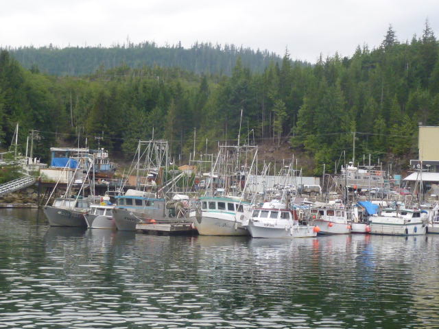
Gill Net Fleet Waiting for Opening at Shearwater
Shearwater (August 7 - 12):  On Thursday I undertook a project I had been thinking about for a while.  We had replaced the anchor wash down pump in Campbell River - a nice improvement.  But, as I try to do, I thought about the worst case scenario.  The pump lives in a space below the deck in the forward head.  It takes in sea water via a through-hole (a hole in the bottom of the boat) controlled by a valve.  If the fitting on the pump were to fail then sea water would rush in - not good.  The solution is to make a loop in a longer intake hose which extends above the water line.  Now, if the fitting fails, no water can come in.  I did so by drilling two holes through the deck in the cabinet space below the sink and looping the intake hose through them so that it was about 6" above the sink drain, which I know is above the water line.  I opened the intake valve - no water rushed in!  Reconnected the intake hose to the pump and we're back in business.  I'll sleep a little better now.

While here, I have spent quite a bit of time catching up on internet required tasks.  I made flight reservations for our trip to Kauai and the Big Island in March/April.  I found a lawyer in Port McNeill who will act as a Public Notary for some documents we need to sign.  And I researched various boat related items.  Our solar installation on our California house has been a success (latest monthly bill was $2.66 - for meter rental) so I am thinking about solar for the boat.  Preliminary figures suggest that we can cut our generator run time (which costs about $1.75/hr) by as much as half which means that we could stay at anchor for two days without running it.  I think I can do it for less than $1500 and the boat qualifies as a residence for a 30% solar tax credit.  More study is required.


Supplemental Log of First Mate Brian Shellum:

Crew Member – It is important that anybody joining Rolynn and Steve on the boat for any period of time make themselves useful crew members.  There are plenty of duties to go around and I am amazed that Rolynn and Steve alone manage to crew a 42 foot, 20 ton Krogen by themselves.  My station for anchoring each afternoon and pulling up anchor each morning was to man the dinghy, which meant I had to pull it to the side and make it secure so it didn’t get in the way of the boat or the line fouled in the propeller.  When we docked I secured the dinghy, put out the fenders, and assisted tying the starboard lines to the dock.  I also occasionally conned Intrepid when Steve and Rolynn were busy with other duties.  And then there are the less glamorous duties like washing and drying dishes and cleaning fish, crabs, and shrimp.  The critical thing is that you are a participant and not an observer, allowing you to contribute and get an appreciation for how difficult it is to crew a boat in very challenging waters.

Nautical Terms – A basic knowledge of nautical terms and skills is essential when spending time on a boat.  At a minimum, you should know bow (front), aft (rear), starboard (right), and port (left).  It’s also kind of nice to know that the bathroom is referred to as a head, a bed a birth, and the kitchen a galley.  If you plan on helping secure lines to boat or dock cleats, you had should learn to do a basic cleat hitch with locking turns.  Never thought my Boy Scout training would come in so handy!

Speaking German in Ocean City – You never know when you will be able to practice your foreign language skills. I was cleaning my salmon catch at the marina in Ocean Falls when approached by the crew of a large sailing boat that I had noticed were flying German flags. I asked them where they hailed from, in German of course, and one of them responded Bonn, a place I had lived for four years.  We had a long discussion about sailing, salmon, and living in Bonn in one of the longest and liveliest conversation in German I have had since leaving that country in 1992. Once the two men from the sailboat left, I found that another man who had been eavesdropping was formerly from Germany and had lived in British Columbia since the 1960s. So we continued the discussion in German.  It is a small world indeed.

Civilization – The passage back to civilization after two weeks aboard "Intrepid" was every bit as daunting as the original outbound journey. I discussed my earlier trip from Washington to Vancouver and from Vancouver to Bella Bella in my initial log entry.  On the return water taxi trip to Bella Bella I was the only passenger and the captain, a First Nation fellow named Vince, invited me up to the bridge to chat.  We talked about fishing, life as a member of the Heiltsuk Nation, and oddly enough about American Football (he was a Denver Bronco fan).  When we reached the public dock at Bella Bella, the taxi was waiting to take me to the airport, which didn’t seem as shabby or unfamiliar to me as it had two weeks prior.  I was reluctant to leave.  As the flights to Vancouver, San Francisco, and Washington brought me back to civilization, I found myself missing the quiet solitude of life on "Intrepid" and the wonderful routine we had established.  Rolynn and Steve are very lucky to have such a life!


Rolynn returned from Las Vegas at 15:00 on the 12th, her RONE Award Runner-up Certificate clutched firmly in hand.  She was happy she went, I guess, but the conference itself was poorly organized.  Nonetheless, she learned some valuable things.  She always manages to make even a poor experience work to her benefit.  It’s a mystery.

Shearwater to Snug Cove (Bowen Island): August 13 - 29

After paying the moorage and topping off the water we departed Shearwater at 09:15 for Fury Cove - 7 hours away.  It was flat calm in Fitz Hugh.  In the distance we saw a whale leap completely clear of the water - just like the insurance commercial.  Its amazing how a 40 ton animal can generate such power.  No one really knows why they do it.  One theory is that they want to get a view of their surroundings.

As we neared Fury Cove at the southern end of Fitz Hugh Sound we listened to the weather again.  Tomorrow the wind will come up so we will be stuck in Fury for two days, at least.  But, the rest of today looks good.  The wind at Egg Island is light with low westerly swell.  West Sea Otter reports 0.2 meters and we have a half moon - neap tides.  So, we decided to cross Cape Caution, even though it is the afternoon, and go on to Allison Harbor.  It will make a long day but it seems worth it.  The Cape turned out to be as flat as we have ever seen.  It was so calm that we grilled steaks on the BBQ underway.  We dropped anchor in Allison at sunset, a little after 21:00.  A twelve hour day.  We were tired but happy that we had read the weather window correctly and saved at least two days.

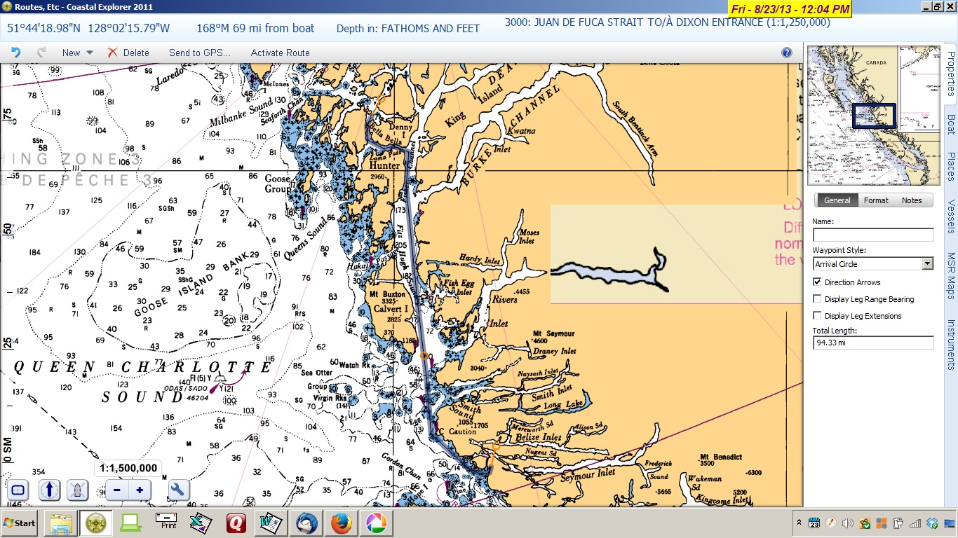
Shearwater to Allison Harbor
On Wednesday we waited in Allison until 09:00 so that I could call the lawyer in Port McNeill.  If I could change my appointment to Thursday or Friday we would go there.  If not then we would head to Sullivan Bay then to McNeill on Sunday.  The lawyer was a go so we headed across Queen Charolotte Straits to McNeill - five hours away.  By noon a SW wind had come up but we were driving into it so it was OK - about a 2 ft chop.  There are a bunch of islands in the way so it is probably 1.5 hours longer to McNeill than the crow flies.  The marinas were full when we arrived at about 15:00 so we went on the waiting list and then anchored across the bay for the night with a half dozen other boats.  The wind was freshening as we anchored so I played out 125' of rode in 25' of water - a 5:1 scope as opposed to our usual 3:1.  I pulled the anchor deep into the mud bottom for an good grab.  By dinner time we were hopping around pretty good - so much so that I had to wedge myself against the freezer door to dry the dishes.  I was preparing to stay up for an anchor watch even though we had not budged from our original position.  But, as had been forecast, the wind dropped around 22:00.  It was like the wind switch had been turned off.  We slept well through a calm night.

Thursday:  By 11:00 we were at the dock in McNeill.  Marika, Anca and Max's daughter (Kwatsi Bay), works the docks as her summer job and was there to help us into a tight spot.  We went ashore to get a latte.  I trudged up the hill to the lawyer's office to get the docs notarized and then mailed them from the post office.  (It turns out that there are no title companies in Canada.  All real estate transactions are handled between lawyers so they are all notaries, hence, there are few other notaries.)  Mean while, Rolynn had run into Linda Lewis, a boating friend.  She is a professor emeritus at the UW school of nursing.  After retiring she got her 100 ton captain's license and now teaches navigation and boating skills.  She is very knowledgeable, to say the least.  (She and her husband were anchored with us in Glacier Bay, AK during the episode of the wrestling grizzlies.)  This year, David decided to stay home so Linda is single-handing their boat while various woman friends join her from time to time.  We joined up for dinner and had a nice conversation.

Friday:  Rolynn is doing all kinds of book stuff and it is a day for laundry, shopping and the like.  In all likelihood, we will recross the straits Sunday, anchor here and there for a couple days then go to Pierre's for prime rib.  We will continue the grand tour of the Broughtons, revisiting friends and old haunts, with the object of being at Refuge Cove in Desolation Sound on the 29th to pick up our friends Bill and Judy who will be with us until we arrive in Anacortes on about Sept 5 or 6.

Sunday/Monday:  After a benign three hour crossing of Queen Charolotte Straits we anchored for two nights in Waddington Bay, a pretty and popular spot which we shared with eight other boats, or so.  We read, did a few boat chores and otherwise relaxed.  Well, I relaxed - Rolynn doesn't do "relax" very well.

Tuesday/Wednesday - Pierre's Resort at Echo Bay:
  It is jammed because of the Echo Bay Yacht Club annual rendezvous.  There is no "yacht club" per se since their only purpose is to gather here once a year.  The mean age of their members is 104 - conservatively.  Anyway, we joined them at their "Texas BBQ" - I manned the defibrillator station.  Wednesday is Prime Rib night.

Thursday/Friday - Kwatsi Bay:  As we entered the bay we saw a pod of approximately 300 dolphins thrashing the water.  They were after the pink and coho salmon which are heading for the streams now. They cooperate in their feeding by repeatedly herding the salmon into a group and then munching them down.  One boater said he got a picture of a bear swimming among the dolphins.  He was after the fish, too.  Haven't seen the picture.  The bear is lucky he didn't get the shit kicked out him by the dolphins.  They are bigger than the bear.

There are only six boats here so the evening conversation around the pot-luck happy hour was intimate and interesting.

Saturday - Lagoon Cove:  We left our friends at Kwatsi and made for Lagoon Cove.  I have written about Lagoon Cove and it's owners, Bill and Jean Barber, before.  They have owned and operated the facility since 1992 after Bill retired from a career in business. Lagoon has been a boat and furniture making shop, a boat yard, a marina and other operations for at least 75 years.  Sadly, Bill died of cancer over the winter.  He had no symptoms.  The cancer was discovered via routine blood tests during his annual physical.  He was 80 years old.  So Jean and her loyal crew, Pat and Bob, are operating the marina, at least for the time being.  It is for sale and has been for a few years.  One way or another, Lagoon Cove, as we know it, will disappear like so many other places along this coast.  We left, thinking that it might be for the last time. 

In Remembrance of Bill:  Bill always told a story or two at happy hour.  Usually the same ones, like how he taught a bear how to water ski.  Even so, the old timers still paid attention.  Here is one of my favorites.

A young guy accepted a job as a winter watchman at a remote logging camp at the far end of Knight Inlet.  After a few months of isolation he heard a knock at his cabin door.  There stood a burly logger - greasy hair to his shoulders, a long knotted beard, and clothes that had not been washed for months.  The man introduced himself as a "neighbor", only twelve miles away.  Since the watchman was still there the visitor figured he might stick around  so it was not a waste of his time to pay a visit. 

"I'm gonna have a party" he said, "Wanna come?" 

Edging up wind, the young man replied, "You bet, I haven’t seen a soul  for months!" 

"Well", said the visitor, "I've gotta warn you, there's gonna be some drinken."

"That's fine, a little snort never hurt me."

"And cussen, there'll be a lot of cussen, too."

"Oh, that doesn't bother me much"

"And fighten, always some fighten.  Bad ones."

"Well, I hope not but I guess I can handle myself."

"And, sex, too.  Lots of sex.", warned the logger.

"Now we're talking", thought the watchman.  "I'm in.  What should I wear?"

"Nothing special", replied the logger.  "Just gonna be you and me."


Smooth sailing, Bill.

Tomorrow we move just around the corner a ways to Port Harvey.  Harvey is at the cusp of Johnstone Straits so it is a good place for an early morning departure.  The weather looks good, SE 10-15, but there will be a strong ebb current against us starting about noon so we will leave early and be into Sunderland Channel by then.  That's the plan, anyway.

Sunday:  At about 07:00 I was awakened by the Environmental Compliance Officer (Rolynn) and informed that we would be leaving immediately.  She had been listening to the early morning weather and the Monday forecast for Johnstone had changed from 10-15 kts to 20-30 kts.  So, the revised plan is to skip Harvey and go down Johnstone to Forward Harbor today.  Okay-Dokay.  We were away from the dock by 08:00 and heading through the Blow-Hole, the entrance to Lagoon Cove, so named because in the winter the winds can howl out of adjacent Knight Inlet causing water spouts in the cove.  Anyway, as we rounded the Broken Islands at the junction of Johnstone Straits and Havannah Cannel we found light winds and a rippled sea.  About three hours later we were in Sunderland Channel, approaching Forward Harbor, our anchorage near the northern of the five tidal rapids we must transit.  But, a little math revealed that we can make Whirlpool and Greenpoint Rapids without stopping at Forward Harbor so we kept going, planning to stop at Greenpoint Island Anchorage for the night.

A Rapid Review:  The strength of the rapids, and thus the narrowness of the safe time window available for transit, is dependent on the tides.   Spring tides are higher than neap tides.  Ebb tide currents are stronger than flood tide.  And the lower of the two daily ebb tides is stronger than the higher ebb.  Today, we are facing a lower-low water, spring, ebb so the window is small.  But, here's the good news.  The time of slack water (minimal current) arrives first in the north then moves south.  However, it moves south faster than we do.  So, we have to transit Whirlpool, the northern most rapid before slack.  Sometime during our journey south the slack overtakes us and then arrives at Greenpoint before we do.  Therefore, we must transit Greenpoint after the slack.  We try to time things, if we can, so that the current is less than two knots when we transit.  But, a boat's steering response is a function of the speed of the water passing over the rudder.  So, we have better steering moving against the current than with it.  The ebb currents in these parts flow north, against us, so we can usually tolerate a little more than 2 knots.  But, they call it "Whirlpool" for a reason so we don't push our luck too much.

Descending the Rapids
We passed Whirlpool with 2.5 knots against us and then Greenpoint with minimal current.  But, looking at tomorrow and considering a little more math, we decided to skip Greenpoint Island Anchorage and continue on to Shoal Bay.  Shoal is closer to the southern three rapids and it will be easier to make the morning slacks starting from there than farther north.  So, we kept going, again, and pulled into Shoal Bay at about 15:00.  We normally anchor here but the little government maintained dock has been restored and had room for us so we tied up.  We are here two days earlier than planned so will stay two nights, given that the wind is supposed to begin blowing Monday afternoon.  The guy that lives at Shoal Bay has a little pub where local fishermen gather between the slacks.  He has built a brick oven on the pub patio where he will bake pizza for you but have to bring your own toppings.
Downtown Shoal Bay

I had intended to post this blog from Harvey but we passed that by.  In the past there has been wifi here at Shoal but not today.  Don't know why.  So, I probably won't get this posted until Refuge Cove on Thursday or maybe Lund on Friday.

Refuge Cove Store
Thursday, August 29 - Refuge Cove:  We have not been here for several years.  It is the busiest place in the Desolation Sound area.  It was founded in 1917 and then purchased by the Hope family in 1945 who developed the property and operated the store for many years.  In 1972, eighteen friends from Vancouver and Victoria formed a cooperative to purchase the property from the Hopes who continued to live out their lives here.  The original shareholders were in their 30's at that time but those that survive and remain are now in 70's, - their homes scattered among the 186 acres.  Of course some of the shares have changed hands over the years.  Four are currently for sale.  You can pick one up for $275,000, or so.  Only four live here year around.  Now, there is a fuel dock, marina, general store, cafe, and "art" store.  The business properties are leased by the co-op to the respective operators who are co-op members themselves.  The homes range from nice to collapsing.  We are meeting our friends Judy Moore and Bill Whittemore here who are flying in from Anacortes via float plane.  They will be with us until we return to Anacortes on Sept. 5, or so.

Downtown Refuge Cove
Well, so much for that.  We just found out that Bill and Judy's flight has been cancelled due to the weather so they are not coming.  Such are the vicissitudes of cruising with friends.  Too bad.  We were looking for ward to having them aboard.

Friday - Lund:  After a latte and cinnamon roll at the outdoor coffee shop we headed about two hours south to Lund.  Lund is the end of the road, literally.  The other end is Terra del Fuego.  The only way up the coast from here is by boat or plane.  The natives were here first, of course, but in the late 1800's the Thulin brothers started logging operations here and named the town after their village home in Norway.  Thulin Passage winds its way through the Copeland Islands immediately north of here.  We like Lund.  There's a good pub/restaurant, grocery store, gift shops and Nancy's Bakery, aka "The Cardiac Hut" .  It's the kind of place we can no longer patronize.

The SE winds we have experienced for several days are predicted to lighten and veer to a fair weather NW wind by tomorrow morning so we will continue our way down the mainland coast to Pender Harbor, about five hours journey.  After a stop at Nancy's.

Union Steamship Marina - Snug Cove
Sunday - Snug Cove:  We had a calm night in Pender Harbor then moved another five hours south to Snug Cove on Bowen Island in Howe Sound, just north of Vancouver.  We had flat water and sunny skies all the way.  This is a nice place to end our cruise.  Bowen Island has long been the summer and weekend playground for Vancouverites.  Now, many of the residents commute to downtown via the ferry.  It has a good combination of funk and yuppie excess.

Howe Sound
We are meeting our friends Stephanie and Alan here for dinner.  They live in nearby West Vancouver and will take the ferry to here. 

Cruise Summary:  By the time we return to Anacortes in two days we will have covered 1275 nm in 201 hrs of running and will burned approximately 600 gallons of fuel.  I began this blog by promising to give readers an idea of the costs associated with a cruise like this.  So ----

Winter Maintenance - $4170
Spare Parts - $1000
Spring Maintenance - $2660
Fuel - $1860
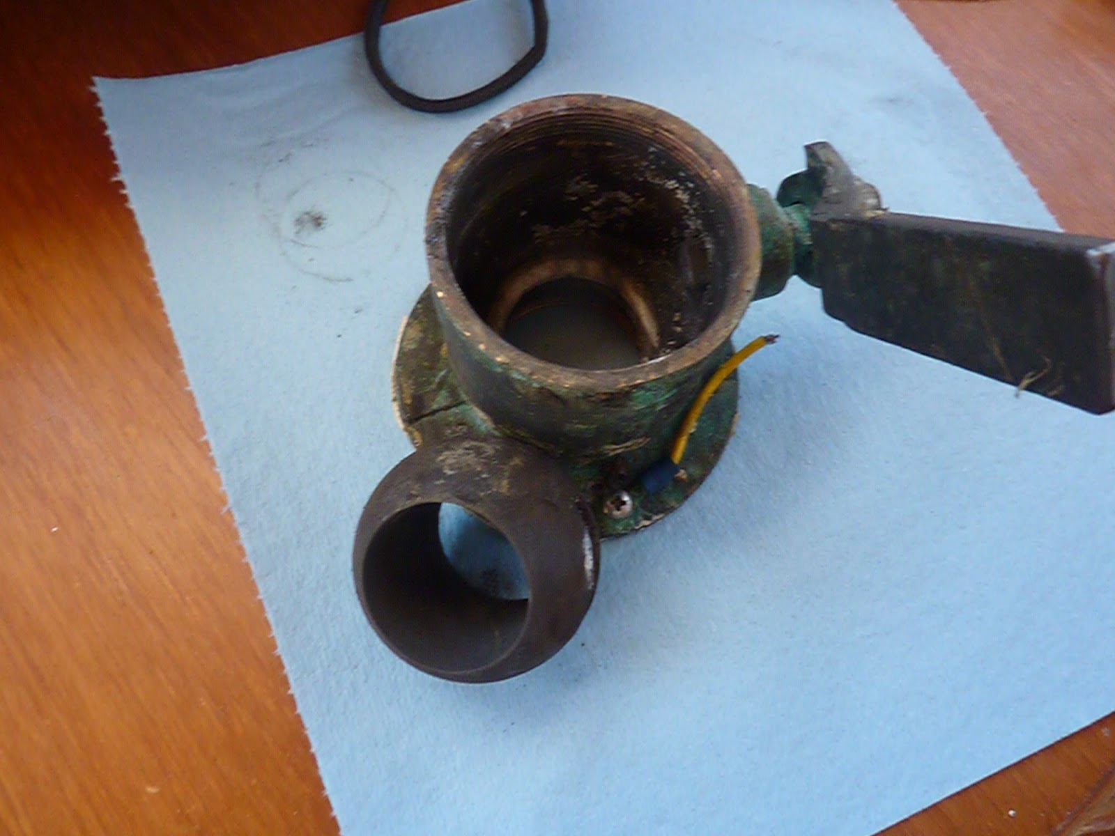
In Cruise Maintenance - $1564
Moorage - $1960

Total = $13,214

Well, that is a lot of money.  But we had a lot of fun, too.  And besides, what would a two month vacation to just about anywhere cost?

Next year - Alaska!

Saturday, August 3, 2013

Ocean Falls to Shearwater

Guest Blogger Brian Shellum Continues:


27 July - Ocean Falls
Another day to fish for Pink Salmon! After a leisurely morning of coffee, a breakfast of yogurt with fruit and granola, and posting photos on Facebook, Rolynn and I set out for the Martin River in the dinghy Steve and I had repaired the previous day. The dinghy ride was far faster and easier than the mile hike the day prior. We beached the dinghy at low tide near the mouth of the Martin River, and to our delight found that the Pinks were still there. I guess the salmon were waiting for the right tidal conditions to swim up the Martin River to spawn. I gave Rolynn a quick primer on the use to a spin-casting rod, and she eventually got the hang of it. She hooked a few but did not catch any.  I used my fly rod and caught five nice ones, and lost several others. Each provided a great fight lasting five to ten minutes, some jumping and others trying to run for the open ocean. I kept the final one for the following day's dinner. All were in the five to seven pound range, with beautiful spotted coloring on their sides and tails. Some of the males had humps on their backs and hooked lower jaws that they get when they are ready to spawn. They are sometimes referred to as "Humpies." After a round of celebratory gin and tonics, we walked to the Dark Shadows Lodge for a dinner of fish and chips. We had dinner together with Jack and Maureen Larsen, from Gig Harbor, Washington, who were at the marina with their boat "Loon a Sea".  We chatted a bit with the owners and operators of the lodge, since we were the only guests besides some tree cutters who were staying there.   

28 July - Ocean Falls to Troup Narrows

After breakfast Rolynn and I walked up to take one more look at the town before leaving Ocean Falls. We stopped at the lodge and chatted with the owners again and also talked to the owner of the marina, Burt, who we had met the day before. He took us on a tour of his large building that houses a marine ways, which could accommodate a fairly large ship pulled out of the water on a rail equipped ramp. Burt let us take a tour of Nearly Normal Norman's museum, housed in the building. Norman was busy working at the marina so he was not present. On the way out of Cousins Inlet after leaving Ocean Falls, we tried catching halibut in Wallace Cove with no luck. After catching salmon on a fly rod I'm not sure I can get excited about bottom fishing, but then I have not caught a halibut yet. We arrived at a wonderful spot in Troup Narrows and Rolynn won the anchorage bet as there were two boats there before us.  Prior to settling in for gin and tonics Rolynn and I put the crab pot out. Steve grilled a pork loin and the Pink Salmon I caught yesterday. Rolynn supplemented the meal with grilled vegetables and noodles. While cooking dinner, we witnessed something extraordinary. A Bald Eagle swooped in to grab a fish, but it must have been too heavy and he got stranded in the water. I watched through the binoculars as he laboriously swam to shore in a sort of bird breast stroke. It was a near thing but he reached shore before running out of strength in the cold water. After drying his feathers a bit on shore he flew to a branch about ten feet off the ground. Once dry enough to fly, the eagle took to the air and soared around the bay drying his feathers. Quite and unusual sight! After dinner Rolynn and I checked the crab pot and found we had nine Dungeness Crabs; six were keepers. I won the crab bet since I guessed five. Dinner for tomorrow!

29 July - Troup Narrows to Roscoe Inlet
After a leisurely coffee and breakfast, we weighed anchor and set out not the five hour cruise up Roscoe Inlet covering about 35 miles. Underway Steve and I cleaned the crabs caught the previous afternoon, the largest we have seen. Steve employs a unique method of grabbing a set of crab limbs in each hand and twisting, separating the edible portion of the legs and claws from the carapace; very neat and quick when done properly.
Crab Cleaning
I managed to clean my portion without losing a finger to these large beasts. We headed out of Troup Narrows through Return Channel for the long and winding trip up Roscoe, a steep sided inlet that makes a makes at least eight sharp turns and passes through three narrows. The head of Roscoe Inlet is surrounded by 4000 meter weathered granite peaks topped with snow fields that feed waterfalls trickling into the fjord. The freshwater floats on top of the saltwater and lingers at the end of the inlet because of the tides, making it possible to swim in the relatively warmer surface water. There were no other boats at anchor when we reached the end of Roscoe, so Steve won the anchorage bet, his first win of the trip. Steve dropped anchor in 75 feet of water in this difficult anchorage, and we settled in for the afternoon. The air temperature was 80 when we arrived, and the surface water temperature 75, the warmest temperatures seen so far during the cruise. After gin and tonics Rolynn and I cruised around the bay checking out the several creek entrances for depth and sign of fish. It was low tide and impossible to get up any of the creeks and we saw no signs of salmon. No luck fishing in Roscoe but I did have a nice swim! After a wonderful dinner of crab eaten on the aft deck, we settled in for a movie. One small boat joined us in anchorage for the night.

30 July - Roscoe Inlet to Codville Lagoon
We departed Roscoe about 0800 for the five hour trip south down Johnson and Fisher Channels to Codville Lagoon. The weather was sunny and warm for the trip, although Fisher was a bit windy and we sailed through a two foot chop the last hour or so. We had to maneuver through about a dozen commercial fishing boats in Fisher near the entrance to Codville that we gill netting or purse seining for Coho Salmon.
"Humpie" in Fitz Hugh
We also spotted a Humpback Whale swimming in the channel near the fishing boats. The water was calm in Codville Lagoon, an irregular shaped body of water that is well protected with an island in the middle. There were two boats at anchor when we arrived, so Rolynn won the anchorage bet. After anchoring in about forty feet of water, Rolynn and I launched the dinghy to explore the lagoon. We decided to land on the north side of the lagoon where there is a path that leads to Sager Lake. It was a steep and at times difficult climb up through the cedar forest,


bordered by huge trees, lush berry bogs, and beautiful ferns. The lake was picturesque with a long sandy beach stained red from the tannin in the cedar forest.
Brian at Codville Lake
The beach had a number of fresh bear tracks on the sandy shore so we kept our eyes open. I fished with my fly rod and had a number of strikes but only managed to catch one small Cutthroat Trout. We made it back to the dinghy without incident but in the process of getting ready to push out into the water I let the corner of my life preserver touch the water which set off the cartridge filling it with air. Steve found a spare CO2 cartridge in the preserver and we were able to fix it when we got back to Intrepid. After gin and tonics and a fine meal of crab cakes, hamburgers, and pea and cauliflower salad, we settled in for the night.


Brian's Cut Throat Trout
31 July - Codville Lagoon to Kayak Cove
We awoke to thick fog and departed at about 0900 when it began to thin. We picked up the shrimp pot dropped the night before on the way into Codville. After hand reeling in 400 feet of line, I was rewarded with the sight of 40 shrimp. I won the shrimp bet since I guessed 59 and both Rolynn and Steve guessed higher numbers. On the trip south down Fitzhugh Channel we spotted quite a number of Humpback Whales that were breaching, blowing, and wagging their tails. After one sighting, as I was waiting on the foredeck for a photo opportunity, a group of several
The Bears are Here
Humpbacks surfaced on the port side dangerously close to the boat. Steve had slowed the boat to prevent a problem, but they surfaced right next to Intrepid and nearly collided with us. A whale that size, 40 feet and weighing as much as 50 tons, could have sunk the boat. Upon entering the Hakai Recreation Area via Nalau Passage, we left the whales and most of the fog behind. After passing Nalau between Hunter and Stirling Islands, we crossed Kildidt Sound to the Breadner Group of islands. Many of the islands in this area are named after aircraft that participated in the Battle of Britain, such as the Hurricane, Spider, and Spitfire Islands. After cutting through the Brydon and Spider Channels, encountering some very dangerous narrows, we passed around the west side of Hunter Island and Superstition Point to our anchorage at Kayak Cove. The last twenty minutes involved crossing seas open all the way to Asia, but we encountered only very low westerly swells. One boat was already at anchor when we sailed into Kayak, though we had forgotten to make the anchorage bet. The owners of the boat, named the Ibis, gave us a nice-sized Ling Cod they had just caught. Shortly after arriving, and before Rolynn and I could explore the unusual, pristine sandy beach, a coven of kayaks arrived and infested the shoreline. The colorful kayaks and jumbled tents soon spoiled the view of that end of the anchorage. This cove is frequented by kayaks from a nearby eco-tourism lodge and thus the name. Rolynn and I took the dinghy out and trolled the shoreline near the cove, but caught only one small Rock Cod and none of the Coho Salmon that should have been there. After gin and tonics and an appetizer of the shrimp caught earlier, we feasted on lamb chops and roasted potatoes in celebration of Rolynn and Steve's forty-second anniversary. We were also visited by a hummingbird that was attracted by the American flag flying on the aft of the boat!

Kayak Cove to Wizard Cove - 1 August
The fog lifted by morning, and we departed at about 0900 for the three hour cruise up Cultus Sound (Cultus is a Chinook word for worthless), Sans Peur Passage, and Hunter Channel to our next anchorage at Wizard Cove. We were rewarded with the sight of a Sea Otter floating on his back just outside the cove as we departed. Sea Otters were nearly hunted to extinction during the 19th century and are scarce and very wary. We arrived at Wizard cove just before noon and were delighted that the anchorage was empty, since there is  only room for one boat. We anchored in 32 feet of water without incident and Rolynn and I set out to explore the extensive waterway. Every anchorage has a resident
Wizard Cove
seal, a pair of Bald Eagles, and a pair of Kingfishers, and we were not disappointed at Wizard. It is just a matter of waiting, watching, and listening. An eagle usually announces his primacy first, followed by the sharp territorial cry of the kingfisher. The seal is usually last to show himself, a solitary, silent, shiny head bobbing in the water. We entered Wizard Cove at the waning of high tide, so it was fascinating to watch as the water level dropped and exposed more rocks around us until there was only a single narrow escape if we had chosen to do so. But we just settled in for a bit of fishing, reading, and bird-watching. Rolynn baked the Ling Cod fillets with butter, sour cream, mayonnaise, onion, dill, Santa Maria mix, and a little paprika. The results were amazing. Best fish so far, and that is saying a lot!

Wizard Cove to Shearwater - 2 August
We weighed anchor about 0800 for the two hour cruise to Shearwater. We paused outside of Bella Bella and the way so Rolynn could download her e-mail traffic. Steve and I waited until Shearwater. Shearwater was loaded to the gills with boats but the marina had a space reserved for us. We caught up on e-mail while Steve had the marina electrician trouble-shoot the generator. Once that was fixed we trouped to shore to shop in the grocery store and purchase a few gifts. Tonight we will eat at the marina restaurant and celebrate my last day aboard. I will take the water taxi to the airport at 0900 tomorrow morning to catch my 1030 flight back to Vancouver and civilization.

Sunday, July 28, 2013

Pruth Bay to Ocean Falls:  The Shellum Invasion

Saturday, July 13 -  After Pruth we spent a night in Goldstream Harbor - a new spot for us.  The next day we moved on to Codville Lagoon where we pulled up some prawns.  I noted that one of our bilge pumps was not working - loose wire.  A ten minute job that only took two hours.  A 1 to 12 effort to results ratio.  About average for a boat.  Following Codville we moved on to the Dodwell Insland anchorage in Queen's Sound - a very pretty and quiet spot.  While there we put the dinghy down for the first time and soon discovered that the steering was frozen.  I couldn't fix it in the water so back on the boat it went.  Rolynn, the ship's engineer, diagnosed the problem as follows, "The slidey thingy was stuck in the humma-humma tube so it could not activate the frammel lever."  A day and half of sweating, cursing and swatting flies and the steering problem was fixed but the motor could not be tilted up or down.  We left it in the down position and will fix it the next time we put it back on deck.
Dodwell Island Anchorage


Tuesday & Wednesday - From Dodwell we moved north to an unnamed cove that one book calls Wizard Cove.  A pretty spot where we spent two nights.  Tomorrow we will move to Sheartwater Marina, near Bella Bella, where we will meet up with Brian Shellum, Rolynn's brother who will be with us for two weeks.


Guest Blogger Brian Shellum Reports

20 July 2013 - Arrival in Shearwater
Arrived at Bella Bella airfield about 1630. Airstrip might be a better term for this primitive field with a single short runway bordered on both sides by evergreen scrub that seemed to tickle the wingtips on landing. The approach was a bit scary coming through a thick white cloud bank and finding the plane at wave top altitude approaching an island that seemed too small to boast an airstrip. After a short, fast landing and a sharp brake, we taxied to a weathered shack that passed for a terminal. With bags unceremoniously dumped on a homemade plywood stand, we bewildered passengers looked at each other and wondered what next. Each of us in turn looked at our useless smart phones. The few First Nation arrivals were greeted by family members with cars but we outsiders were left to wait for the single taxi in town. After standing in the open and staring down a rough road bordered by scrub that we were certain was thick with bears, the taxi arrived to our considerable relief. Seldom have I felt so helpless and vulnerable. After a short ride through the First Nation town of Bella Bella, where the only grocery store/post office had just burned down, I caught the water taxi across to Shearwater where Rolynn and Steve were waiting to my great relief! After a bracing gin and tonic aboard Intrepid, we celebrated my arrival at the only restaurant for 100 miles! Might be 200 but who is counting? Let the adventures begin!

21 July 2013 - Shearwater to Bottleneck Inlet
I was up first at 0600 and after a coffee took a quick walking tour of Shearwater. The small common at the top of the dock features a newly sodded area with a recently installed Raven Totem and a large model of a British seaplane from World War II. Shearwater was established during World War II as a seaplane base to protect coastal British Columbia from a Japanese attack. The largest structure in the complex is a large hangar built to accommodate
Shearwater Marina
the aircraft. One side of the building is decorated with a new mural that features historical figures from the region. After filling up on fresh water, we were off at 0900 for some salmon fishing enroute to our northern passage (no luck on the salmon). The day was beautiful as we sailed north up Mathieson Channel and through Jackson Passage to Finlayson Channel to our first anchorage at Bottleneck Inlet, about a six hour trip. Bottle Inlet is a tiny cove and that was already occupied by four other boats when we arrived. Rolynn and Steve always bet on how many boats will be present on arrival their next anchorage and Rolynn won (hereafter called the anchorage bet). We dropped anchor between two boats and settled in for the night. Rolynn and I fished and she caught a five pound flounder.

Culpepper Rapids
22 July 2013 - Bottleneck Inlet to Culpepper LagoonWe departed Bottleneck early for the long run up Mathieson Channel and Sheep Passage to Kynock Inlet to our anchorage in Culpepper Lagoon, about a six hour trip. On the way north we spotted a pod of three orcas-one adult and two youngsters-unusual for this far north and inland. We also encountered a large pod of Pacific White-sided Dolphins which danced in the bow wave of Intrepid. We stopped in Sheep Passage to fish for halibut with no luck. After navigating Sheep Passage and rounding Mathieson Point, we turned east into Kynoch Inlet. Kynoch is magnificent with steep-sided mountains and lacy waterfalls. Culpepper is guarded by very narrow rapids that has to be entered at slack tide. We arrived at about 1300 and cruised through with little effort. We were greeted on the other side of the rapids by a pair of Pacific White-sided Dolphins that escorted us to the far end of the lagoon. Rolynn called to them and they seemed very interested in entertaining us with their acrobatic antics. It is a strange feeling to make conscious eye contact with a creature of obvious intelligence.

We were greeted on the other side of the rapids by a pair of Pacific White-sided Porpoises that escorted us to the far end of the lagoon. Rolynn called to them and they seemed very interested in entertaining us with their acrobatic antics. It is a strange feeling to make conscious eye contact with a creature of obvious intelligence. As they rode in the bow wave of Intrepid, they repeatedly rolled on their sides and looked up at us. They clearly responded to our hand gestures and calls with more antics. Upon reaching the end of the lagoon we anchored-a difficult task in such a deep-sided lagoon. I won the anchorage bet since there were no other boats in Culpepper and I guessed zero. Rolynn and I launched the dinghy and placed the crab pot in a spot where they had caught many before. We placed bets on how many crabs we would have in the basket the following morning (hereafter called to as the crab bet). We took the dingy down the river at high tide scouting for fish and watching for bears. For dinner we feasted on grilled sausage and fish, cannelloni with meat balls, and a red wine. The end of the lagoon was loaded with birds and seals that kept us entertained all night. Because the generator was not charging we decided not to stay in Culpepper two nights as previously planned. We needed to be underway each day to charge up the batteries to keep the boat supplied with electricity. Steve will arrange to get the generator fixed in Shearwater when they take me there to fly out on 2 August.


Culpepper Anchorage
23 July 2013 - Culpepper Lagoon to Bowlin Bay
Rolynn and I were out early in the dinghy to pick up the crab pot since we had to make the slack through the narrows at about 0800. I won the crab bet since I picked 8 crabs and we had six males large enough to keep. Our pair of Culpepper Dolphins escorted us out of the lagoon and to the rapids. The rapids where too shallow and swift to enter so we waited about 30 minutes before proceeding. We made a side trip up Mussel Inlet to view its picturesque bays, steep-sided mountains, and gorgeous waterfalls. Mussel Inlet gets its name from a 1793 incident involving a member of the Vancouver expedition. The rowboat Vancouver sent up this inlet, charting the waters and looking for
Rolynn's Nautical Garden
an eastward passage, stopped for breakfast at its innermost reach. The men supplemented their meager rations on mussels they caught and several soon became sick. One man, John Carter, died and was later buried at nearby Carter Bay, one of the first known victims of red tide. Mussel Inlet is a difficult place to find a safe anchorage, though we did find one sailboat anchored there. Retracing our steps down Sheep Passage, we tucked into Bowlin Bay for the day. On the way into Bowlin we dropped a shimp basket in about 300 feet of water. Rolynn and I launched the dingy and did some bottom fishing, each catching small rockfish which we then used for halibut bait. I later got a good bite and found a halibut had taken a good bite out of my rockfish. At supper we feasted on a fresh green salad harvested from Rolynn's cabin-top garden, home made cornbread, and the six large Dungeness Crabs caught in Culpepper, throwing the carcasses off the aft deck as we enjoyed the panoramic view of Bowlin Bay.


23 July 2013 - Culpepper Lagoon to Bowlin Bay
Lizette Falls - Mussel Inlet
Rolynn and I were out early in the dinghy to pick up the crab pot since we had to make the slack through the narrows at about 0800. I won the crab bet since I picked 8 crabs and we had six males large enough to keep. Our pair of Culpepper porpoises escorted us out of the lagoon and to the rapids. The rapids where too shallow and swift to enter so we waited about 30 minutes before proceeding.

24 July - Bowlin Bay to Oliver Cove
Next morning I fished for the salmon that were jumping all around the boat with no luck. Later I did some bottom fishing and caught a few small sole and a Pollock. Rolynn and I sat on the aft, savored our coffee, and watched the morning break at low tide on the bay before us. We decided to rename it Bird Bay because of the number and variety of birds. We watched two adult eagles keep watch over a juvenile bird that still had mottled dark brown and white feathers. An Osprey slapped the water, snatched the salmon that I should have caught, and quickly flew inland to avoid trouble with the eagles. There were also hundreds of shore birds: Pigeon Guillemots, Marbled Murrelets, Bonapart's Gulls, and more. A resident pair of seals circled the boat, eyed us curiously, and fed on the other salmon I should have caught. On the way out of Bowlin/Bird Bay we picked up the shrimp basket. Rolynn won the shrimp bet since she guessed closest to zero shrimp. The trip back down Mathieson Channel was uneventful and we arrived in Oliver cove about 1400, a six hour trip. We forgot to make the anchorage bet, but there were four boats at anchor before we arrived. It was overcast and a bit chilly when we settled in for our afternoon ritual of Gin and Tonics. The evening horsd'oeurves was crab cakes, made with yesterday's leftover Dungeness Crabs. For supper we had Reuben Sandwiches and Rolynn's homemade coleslaw. Rolynn and I explored the nearby Boat Harbor in the dingy before settling into an evening of reading.

Oliver Cove
25 July 2013 - Oliver Cove to Ocean Falls
We awoke to blue skies after the light fog burned off. This would be the sunniest and hottest day so far. We weighed anchor at 0800 and sailed south through Reid Passage, west through Seaforth Channel and Gunboat Passage, and finally north through Fisher Channel to Cousins Inlet and Ocean Falls, a five hour trip. Gunboat Passage gets very tight in several spots, especially at slack tide. As we made the passage we crossed the the cable lines that run from Ocean Falls that connect to Shearwater and Bella Bella and provide electricity from the plant that generates power from the dam there. Ocean Falls was founded as a paper mill town in 1906 and had a population of 3500 by 1950. After the paper mill closed in 1973, the town gradually lost its residents. The town now is a virtual ghost town with fewer than two dozen full-time residents, not counting the nearby housing area called Martinville. Houses, a large hotel, a church, a high-rise apartment complex, and former paper mill buildings all sit vacant. As you approach by boat and view the town from Cousins Inlet, Ocean Falls appears to be a prosperous town. As you get closer you see the emptiness and decay. The only thing left in the town is the power plant and a salmon fish hatchery. The towns most famous resident is Nearly Normal Norman who hosts a museum in Ocean Falls. Rolynn and I toured the town after we docked and met the few residents: the operators of the marina, caretaker at the Ocean Falls Fishing Lodge, folks who run the Dark Waters Lodge, and of course Norman. We walked to the top of the dam to view the spillway and see Link Lake. We wandered through neighborhoods of once cozy houses that were overgrown with moss and vines and ready to crumble. Sad to see a once vibrant town that once boasted two Olympic sized pools brought so low.

Downtown Ocean Falls
26 July - Ocean Falls
A whole day to fish! Steve stayed behind to work on the dingy that wasn't working properly and Rolynn caught up on her e-mail since we had a good WiFi connection. I set off for the half mile hike up the hill to Link Lake, but a worker at the fish hatchery told  me pink salmon were biting at Martin River. I turned around, walked back to the boat, grabbed my tidal fishing license, and set off on the one mile walk to Martinville. When I arrived, I saw hundreds of pink salmon in the shallows near the mouth of the Martin River. I fished first with my fly rod with no luck. After switching to Rolynn's spinning rod I had success. First I caught a six pound female pink; then an eight pound male. Next I hooked a large fish that I fought for ten minutes until it ran straight out to sea and I couldn't stop it before it broke my line. I then caught a seven pound female. Since I only had one more fish to catch to reach my limit, I switched to my fly rod. I hooked a large ten pound male and after a ten minute fight netted him; the most fun I have ever had with a fly rod! Flushed with success,
Brian and his Pinks!
I still had to get back to the boat. I loaded the four fish into my Wilson gym bag (closest thing Rolynn had to a fish net), stacked them head first into my backpack (my son's former DC school bag), slung the fishing net over the backpack, hefted one rod in each hand, and set off on the one mile hike back to the boat. I hadn't done a 40 pound ruck sack march since my army days. I reached the boat and demanded a beer before I showed my fish! After weighing, measuring, documenting, and gloating over the fish, Rolynn and I cleaned the four salmon. We had a seal standing by to eat all left over after cleaning the fish. That accomplished, Steve grilled the largest fish to eat for supper and froze the other three. What a feast. More fishing tomorrow when I will give Rolynn a lesson on the use of a spin-casting rod.


Friday, July 12, 2013

North of the Cape: Brown's Bay to Pruth Bay


Friday, July 5 - The 05:00 sea conditions report gave us 15 kn NW with a 2 ft chop at Chatham Point (where Discovery Channel becomes Johnstone Strait) on a ebb tide (against the wind).  The wind  will increase to 30-35 late in the day.  Given that we have several exit points west of Chatham we decided to go for it.  Our intention is to get to Forward Harbor from which we can make the final leg up Johnstone tomorrow.  If it gets awful before Chatham we can turn around and go back to Brown's Bay or continue south, back through Seymour, on the morning slack and go up the inside route through the rapids.

Brown's Bay to Sullivan Bay
We passed Okisollo Channel, the first exit point and when we turned the corner at Chatham it was, indeed, about a 2 ft chop which gave us no difficulty.  So, we passed up the second exit point, Nodales Channel, and pushed west.  At the Walkem Islands we had the option of sneaking through the channel behind islands but we had not done that before and the chart was unclear, to us at least, as to the best route.  So, we stuck to the main channel.  Soon, we were in patch of "square waves' - seven feet high and seven feet apart, and these were almost vertical.  Such waves come at you so fast that the boat does not have a chance to slide down the first wave and rise up the second so it just buries its bow in the ditch between the waves.  The ebb tide was pushing us so we had trouble slowing down enough for the boat to establish a rhythm.  As soon as we passed the Walkems, though, things calmed down.  Just then we saw a southbound boat come out of Mayne Passage and go behind the islands.  We made a note of that for next time.

We debated, for a while, whether or not to turn up Mayne or continue up Johnstone to Chancellor Channel.  Timing the rapids was the issue.  The slack water arrives first at Whirlpool, the northern most rapid, then about 40 minutes later it shows up at Shell Point, the southern most.  But it takes us 2.5 hours to get from Shell Point to Whirlpool so we can not make both rapids at slack.  We have to pull up after Shell Point and wait for a few hours then catch the afternoon slack at Whirlpool.  (There is a third rapid at Greenpoint but it has the same slack time as Shell Point.)  By continuing up Johnstone and hooking a right at the west end of Chancellor Channel we could bypass Shell point and Green Point rapids- we would only have to time Whirlpool.  But, it did not look like we could do so and get to Whirlpool for the slack so we made a right into Mayne Passage.  We hit the lower rapids near enough to slack and continued  through Chancellor Channel from its east end.  After turning up Wellbore Channel we intended to pull up just short of Whirlpool and wait.  But, we saw a tug and barge waiting in a little bay at the junction of Chancellor and Wellbore.  It was well after the slack - why was he waiting?  Just then he began heading up Wellbore for the rapids.  Then we saw a pusher tug coming up Chancellor.  The first tug had been waiting for the second.  Together, they went through Whirlpool, the second tug steering the barge from behind.  We decided to follow them and went through the rapids against a 3 kt current with no difficulty. Forward Harbor is just past the rapids and we were at anchor enjoying a G&T by noon. 

Saturday -
The Fanny Island weather station sits in the middle of Johnstone Strait at the mouth of Sunderland Channel.  Sunderland runs in more or less the same direction as Johnstone.  Forward Harbor is well protected and lies at the top of Sunderland, nearly an hour from Johnstone, but one can not usually pick up the weather station on the VHF in Forward.  So the saying is, "What you see in Sunderland, you will see in Johnstone."  We picked up at 06:15 and poked out into Sunderland which looked fine.  Now able to hear the weather station we learned that Fanny Island was reporting NW 10 kts.  This bodes well even though the tide was ebbing.  We studied the weather forecasts more as we cruised up Johnstone.  There appears to be a weather window opening for Queen Charolette Sound next Wednesday which means we would want to be in Allison Harbor the previous night.  Planning backwards leads us to believe we should continue on to Kwatsi Bay today instead of stopping in Lagoon Cove.  That cuts out a day and positions us well for a crossing of the Sound next week.

Seven hours, or so, after departing Forward found us with five other boats in Kwatsi Bay.  We caught up with the marina owners, our friends Anca and Max, and Jim who stays there all summer on his boat "Anchor".  There were only nine people for pot luck so it was good conversation with a good group.  Rolynn left some books on consignment at Anca's little store.

Environment Canada Weather Station: Echo Bay
Sunday - Pierre's Bay:  We hung around Kwatsi until mid-morning then pulled away for the 1.5 hour hike to Pierre's Bay.  We did some house keeping and will do some laundry tomorrow.  A quiet day.  Rolynn stocked their store with some books.

Cliffside at Echo Bay
Monday - Sullivan Bay:  Today it was 2.5 hours to Sullivan Bay, a community of floating homes, a post office, and a restaurant at the top of Wells Passage.  Along the way a pod of pacific whiteside dolphins rode our bow wave for 30 minutes or so.  It is always fun to watch them play. (Rolynn is sure that her antics and yells off the bow enticed the dolphins to jump when she requested...the dolphins had her trained, is what really happened). At the docks we joined in the happy hour. We shared snacks and met some nice folks as well as saw some old acquaintances. 

The Wednesday weather window still looks good so we plan to move along to Allison Harbor, about 4.5 hrs up the coast, which is our jumping off point to go around Cape Caution.


Dolphins on the Bow
Tuesday - Allison Harbor:  We were up early to listen to the weather.  It is an 11 hour trip from Sullivan Bay, around Cape Caution, to Fury Cove at the mouth of Fitz Hugh Sound.  The earliest weather forecast and sea conditions report is at 04:50 so, after listening and discussing, 05:30 is about the earliest we can get underway.  But since the wind almost always comes up in the afternoon we want to be tucked in by about noon.  That makes our trip around the cape a two-day affair.  Allison Harbor is very sheltered, we can wait out any weather there, and the cove is about half way to Fury Cove.  It is a bit of a rock garden getting in but it is well charted and all the rocks are easily identifiable.  It looks a lot worse on the chart than it actually is.  That is often true.  Anyway, we were swinging on the hook by 11:00 and spent a pleasant afternoon.  We barbequed steaks for dinner.

Wednesday - Rounding Cape Caution:   This part may make most of you glaze over.  But, the purpose of this blog is, in part, to help our non-boating friends understand the challenges and decisions required to meet them. 

Queen Charolotte Sound is open to the Pacific Ocean and Cape Caution is a major head-land which must be rounded in order to transverse it.  There are multiple factors to consider when transversing any such body of water.

WIND - The wind in QCS usually flows from anywhere in the SW to NW quadrant.  The wind us usually lightest in the morning and rises to a peak in the late afternoon.  We look for a wind forecast of less than 20 kt but will go in 25 if other conditions are favorable.

TIDE - Spring (big) tides occur at the new and full moons.  Neap (small) tides occur at the half moons.  Ebb tide currents are stronger than flood tides and take the shortest path to the open ocean.  It is big tides running against strong winds that make for rough seas.  A boat running with a 25 kt wind and also with a flood tide may be glass smooth.  But, running into a big ebb opposing a 20 kt wind can be terrible.  The waves pile up, bunch together and become "confused"  ie, they have no consistent, repeating pattern.  The ebb tides in QCS flow, more or less, to the west and the wind comes, more or less, from the west.  Ebb tides and wind usually oppose one another here.

SWELLS - Swells are generated by storms far at sea.  Sometimes as far away as the southern hemisphere where it is winter.  As they roll in from the deep ocean they hit the shallower waters of the Continental Shelf so they get higher and closer together.  There are automated buoys at sea that measure and report the winds and swell heights.  A key buoy for us is named West Sea Otter.  We look for a reading of 1.0 meter or less but will accept a touch more if other conditions are good.  Local winds generate waves which are "on top" of the swells.

SHORE LINE EFFECTS- "Sea conditions are combined wave and swell heights and may vary with depth and shore line effects."  So, says Environment Canada (Canada's NOAA) in every forecast broadcast.  These, too, play into our decision making.  The water off Cape Caution is relatively shallow so a 1.0 meter swell at West Sea Otter may reach 3.0 m at the Cape, with some wind.  And just north of Allison Harbor are Belize, Nugent and Seymour Inlets each containing vast quantities of water all of which must pass through narrow (600 ft) Nakwakto Rapids then out into the sound via Slingsby Channel.  Nakwakto currents are among the world's fastest and can reach 20 kts.  On a big ebb the water gushes out of Slingsby like a fire hose.  The water is shallow and if big swells and strong winds are from the west, opposing the current, it can sink a boat.  The "Slingsby Effect" can extend well out into the sound so we give it a wide berth if she is running at ebb.

Just north of the Cape is Rivers Inlet.  As the name implies, many rivers enter the inlet.  The river outflows amplify the ebb tides flowing out of the inlet.  Again, crossing Rivers on an ebb tide with opposing wind and swells can be very uncomfortable.

COURSE - Finally, what is our course to be?  Geography, being what it is, requires that much of our 5 hr crossing puts the seas on our beam.  That is, we are going more or less north and the waves, wind and swells are coming from the west.  So, we are going to roll unless it is flat calm.  How much depends on the combined effects of all of the above factors.

Rounding the Cape:  Sullivan Bay to Fury Cove
The day's first weather forecasts and sea condition reports are broadcast just before 05:00 so we're listening.  Pine Island lighthouse is west of Allison Harbor and we hope for less than 20 kt winds and no more than a "2 foot chop".  West Sea Otter is 40 miles off the coast.  We want 1.0 meter swells, or less.  Egg Island Lighthouse is just off the Cape.  We want a two foot chop with a low westerly swell.  In a perfect world we want to cross Slingsby at slack and Rivers on the flood all before noon but we rarely get both.  In fact, nature being what she is, we can not hope to get everything we want so we take the best combination we can get or wait for another day.

We listen to the weather at 05:00... the forecast was for 20 kt SW rising to 25-30 NW late in the morning.  West Sea Otter was 1.5 m and Egg Island was 20 kt SW with a 3 ft moderate sea.  3 ft refers to the combined wave and swell height.  "Moderate" refers to how rough the seas are.  We don't know what "moderate" means exactly but it is the fourth of the seven stages of sea conditions.  The seventh is "phenomenal".  We have learned that a 3 ft moderate is not moderate enough for us, especially on the beam.  So, we went back to bed.

At 08:00, West Sea Otter was 10 kt SW and 1.1 meters.  Egg was reporting 15 kt SW and a 2 ft chop with a low westerly swell.  We were under way by 08:30.  We passed Slingsby running at full ebb but her effects were minimal due to the low swells and light winds.  When we turned the corner at Egg Island to a northerly course across the mouth of Rivers Inlet we took low swells on the port beam for an hour or so and a few things hit the floor.  Soon, though, we were more in the lee of Cape Calvert, which guards the mouth of Fitz Hugh Sound, and were anchored in Fury Cove by 13:30.  It was not the best crossing we have ever had, but it was far from the worst.  All in all, we called it a good day.

Egg Island
Thursday - We are anchored in Pruth Bay after a 3 hr jaunt up Fitz Hugh from Fury Cove.  Fury is one of our favorite spots.  Pruth is at the west end of Kwakshua Inlet near the north end of Calvert Island.  The inlet nearly severs the northern tip of the island.  Much of Calvert and the surrounding islands comprise the Hakai Luxbalis Conservancy Area, a huge provincial park.  At the shore of the bay are facilities that once were a luxurious fly-in fishing resort and an outstanding restaurant.  But a couple of years ago the Tula Foundation bought it all and made it a research/conference center.  They host all manner of ecological researchers, archaeologists, cultural anthropologists and the like.  They also broadcast their wifi into the bay for us boaters.

Tula Foundation Facilities - Pruth Bay
We will stay here two days then sneak into the complex of islands and bays north of here loosely known as Queen's Sound.  The more popular name is the Spider or Hurricane Islands.  There was a Canadian naval seaplane base near here during WWII.  Most of the islands were named by the pilots for aircraft used during the Battle of Britain.  We will be in Shearwater Marina on 7/20 to meet Brian, Rolynn's brother, who is joining us for two weeks in Fjordland (and other parts) north of there.


Thursday, July 4, 2013

Emergency at Sea - Anacortes to Brown's Bay (Johnstone Straits)


Monday -  Fueling from the Reisner's truck proceeded uneventfully, except for the impact on our checking account - $1864 for 523 gallons of #2 diesel.  At least it was about $250 less than we would have paid at the fuel dock.  We chatted with Rusty, the driver, then bid him adieu until next year.  "Intrepid" edged away from the dock at 12:15 and pointed herself northwest for a course through the San Juan and Gulf Islands to Montegue Harbor in BC.

The currents were more favorable than the tide tables had predicted so we made the trip in 5.5 hrs - about 48 nm (a nautical mile is 1.14 statute miles).  We like Montegue Harbor for our first night because it is about the right distance and because we can clear Canadian Customs there with out going to a dock to do so.  We have NEXUS cards which allow us to clear customs by phone with a minimum of fuss because we have been previously interviewed, finger-printed, photographed, anally probed, etc.  We just call when we are within 30 minutes of the border.  They have all our info on record.

The big deal for us is how much duty will we have to pay on our gin and wine when we clear customs.  The Canadian and BC governments are keen to maximize their revenues from the importation of such beverages.  They start with what we paid in the states.  (Washington State has the highest prices in the nation but California is cheap so we bring the gin north from there.)  They then mark up the base cost to BC prices, about the same as Washington prices.  On top of that they assess excise tax (based on the alcohol content), duty (for the Hell of it) and sales tax (because they can).  A $14 dollar bottle of California gin ends up costing $50.75.  This time the customs agent only asked if it was for our own consumption (YES!) in which case he did not assess the duty.  We saved about $450!

This obviously called for a celebratory G&T.  As I kept watch on the road ahead, Rolynn booted up the Sodastream which we use to make carbonated beverages, including diet tonic.  When Rolynn went to replace the CO2 cartridge she discovered that the four replacements she thought were full were empty!  NO G&Ts!  This is the very definition of an emergency at sea so we promptly notified the Coast Guard.  They were not alarmed and sent no rescue chopper.  We desperately hope the cartridges can be obtained in Nanaimo.

Tuesday -  After a pleasant night on a mooring buoy in Montegue we cast off at 08:15 to make the 12:00 slack current at Dodd Narrows.  We got there a little early but scooted through with about 2 kn on the nose.  By 13:00 we were tied up in the inner harbor.  Just as we got our lines arranged, Vera, a boating friend who lives in a luxurious high-rise over-looking the harbor, was pecking at my shoulder.  She had seen us pull in and hustled down to invite us up for drinks.


But, we had an emergency to deal with first.  No worries - Vera told us we can get Sodastream cartridges at the London Drugs store nearby.  Inform Lloyd's of London - disaster at sea averted.  While Rolynn did that, I went to the Telus BC store to buy an Internet Key - a device that will allow us to be online cheaper, in the long run, than paying for it in the marinas that do charge. It's basically a cell phone that plugs into the USB port - looks like a thumb drive on

steroids.  Although I had made prior arrangements, completing the purchase was a bit more complicated since we are US citizens purchasing a contract to be used only in Canada - credit checks, etc, were involved. 

After drinks with Len and Vera we grabbed a burger in the local Pub, tried out the Internet Key (success) and called it a night.

Wednesday -  We were up at 05:00 to listen to the marine weather but the sea conditions were up and predicted to get worse so we crawled back in bed.  We will spend Wednesday in Nanaimo.  Later, we had coffee at Starbucks and did a little shopping.

Thursday -  Up at 0 dark 5 AM to listen to the weather.  Looks good and getting better as the day progresses.  Since it is a nearly 10 hour trip today we have to be aware of any changes later in the day.  Out of the harbor at 05:45 via Newcastle Channel and Departure Bay, the "back door" to Nanaimo Harbor.  We had a mostly uneventful trip, under leaden skies with some drizzle, up The Straits of Georgia to Cortes Bay on Cortes Island in Desolation Sound.  However, when we emptied the holding tank we discovered that the thru-hull valve, which is under water, would not close.  (Remember this, Gary?)  So, we have to get hauled in Campbell River to get it replaced but can not do so until next Wednesday.  (Monday is Canada Day).  We could wait until the next regular haul-out but that's a year and a half away.  Better to take care of it now.  So, we will kill some time in this area and Rolynn will make a book sales calls at one of the marinas.

Friday -  We waited in Cortes Bay until 10:30 then pulled up for a slow 3.5 hr cruise to Big Bay, the setting for "Last Resort", Rolynn's first published novel.  It was slow because we did not want to get to the Yuculta Rapids much before the 15:00 slack tide.  The current was less than 2 kn when we passed at 14:30 but at noon it was nearly 9 kn.  We are a 7.5 kn boat so you can see the problem.  Anyway, we are at the Stuart Island community dock and the wind is howling.  It is a phenomena know as the eponymous Bute winds which funnel out of a deep Fjord by the same name.  Big Bay is located at the mouth of the inlet.  Elsewhere the winds are calm or so say the weather people.

Rolynn made a sale of 30 books to the little coop store here so she is pretty happy.  Therefore, so am I.

There is a nice boat anchored in the bay.  "Athena", owned by Marc Andreessen, the inventor of Mosaic (later Netscape) the first modern web browser.  It was his Ph.D. project.  She is 295' and is for sale (http://www.superyachts.com/luxury-yacht-for-sale/athena-1708/)  She can be yours for only $95 million.

We will move on tomorrow but we don't know where yet.  We will nudge our way towards Campbell River but exactly where depends on the weather.

Saturday/Sunday -  We moved a little SW to Van Donop Inlet on the NW corner of Cortes Island.  It has been very warm both days here.  I have been threatening to renovate or replace the pump that is used to wash down the anchor as it comes up.  Its pressure is pretty weenie.  Since we will be in Campbell River for a couple of days I need something to do instead of relax.  So, I pulled the pump out and disassembled it.  It's undersized in the first place and the autopsy indicates that renovation is not a fiscally responsible avenue.  So, I will shop for a new one in CR.

We have been fussing with the freezer which is powered by the battery banks.  It has been shutting down in the middle of the night.  It's not supposed to stop until the voltage gets less than 10.6 volts but we wake up to find it not running (actually cycling on/off).  When the battery charger is running, and the voltage is higher, it works fine.  Since we don't know exactly at what voltage it is stopping I stayed up waiting for it to quit.  By 04:30 it was still running.  Since Rolynn gets up to write at about 06:30 I went to bed.  Later, she reported that the freezer quit at 11.9 volts.  I performed further diagnostics and could determine no reason for the problem.  I spoke with the guy who built and  installed the system and did further checks but to no avail.  We are stumped.  I called a refrigeration service company in CR but we are a week out before they can get to us.  So, we will just have to deal with it as we go along which means we will probably run the generator a little more than normal.  We'll see.  If we are still having trouble at the end of the season we will stop by Bellingham and have the builder/installer crawl through it.

A high pressure is settling in over Haida Gwaii (formerly the Queen Charlotte Islands) and it looks like we are in for a three day blow beginning Monday PM so we will head to CR in the AM instead of Tuesday.

Monday/Tuesday -  On Monday we made the 3 hr trip to Discovery Harbor Marina in Campbell River without difficulty and were tied up at about 13:30.  This is a good place to be stuck.  The marina is adjacent to a mall with big grocery and hardware stores, a chandlers (marine store), Staples, Target, a couple of good restaurants and an excellent native arts shop.  Even a Starbucks.  We did a little shopping and had dinner a shore.  It was a hot day - well into the 80s.

After coffee the following morning, Rolynn proceeded, credit card clutched firmly in hand, to Target, etc, while I headed to the marine store to shop for the anchor wash down pump.  There was a nice selection and I picked out a good quality "middle of the road" Jabsco ($270).  An hour or so later I had it installed and operating.  Big improvement.

Today is Canada Day, the 167th anniversary of the British Parliament's passage of the North American Act which created the nation of Canada from three former British colonies.  There was a nice fireworks display over the harbor which we watched from Intrepid's bow.

Canada Day in Campbell River
Wednesday -  After coffee we motored over to the marine yard for our 12:30 haul out.  This involves the use of a "Travel Lift" which is a remote controlled device that uses slings to pick the boat up out of the water and then wander around the yard to a parking spot.

She Comes Out of the Water
Once in the designated location, the crew places blocks under the keel (they take all the boat's 40,000 lbs) and jack stands along the hull which keep us balanced over the keel.

Looking for a Home
Plug into power and we are home for the night.  The shipwright was there immediately to survey the project and begin work.  The issue, again, is an inoperable through-hull valve for the holding (shit) tank.  It is in the open position, can not be closed, and needs to be replaced.  This involves removal of the backing plate and nut from the inside of the boat and then extracting the fitting from the outside.  The process is then reversed using the replacement.  (Unfortunately, due to some miscommunication, the shipwright first removed the wrong through hull but that was quickly remedied.)   The whole thing only took about 2.5 hrs but the sealant needs to dry over night.  While the work was in progress, Rolynn went into the office to charm the yard manager into splashing us first thing in the morning (ahead of other boats) so that we can make the slack at Seymour Narrows.


The $1200 Offending Valve
Thursday -  Went for coffee and to check email at 07:00.  Back to the yard at 08:00 to pay the bill.  $1194 - about half of that was just getting the boat in and out of the water and laying her up.  You can add another $150 for moorage.  (Are we having fun, yet?)


The Admiral says I should be less technical in my blog posts and say more about the emotional side of boating.  So, ask me how I feel about the new through-hull.


Discovery Passage runs N-S from Campbell River, through Seymour Narrows, and becomes the E-W Johnstone Strait at Chatham Point.  A 25-30 kn wind is blowing from the NW today (and for the rest of the week).  But, the tide is flooding from the west - the same direction as the wind.  Local knowledge says that a NW wind with a flood tide makes for a good transit of the straits.  But, the tide will turn against the wind which will increase later in the day.  We have a plan which calls on us making the slack at the narrows then working against the current along the shore until we get to Chatham Point.  There, we will make the left turn into the full force of the wind.  We can then assess the conditions.  We have several exit points west of there in case we don't like how things are going.
We pointed north for the narrows at 08:30 which will put us there right the 09:30 slack current (which will reach 10 kn later today).  Seymour is one of the most infamous places on the coast because of the currents and Ripple Rock.  Captain George Vancouver described it as "one of the vilest stretches of water in the world." (And he got around.)   Ripple Rock was a submerged twin-peak mountain that lay just nine feet beneath the surface in the center of the narrows. It was a serious hazard to shipping, sinking 119 vessels and taking 114 lives.   On April 5, 1958, after twenty-seven months of tunneling and engineering work, Ripple Rock was blown up with 1,375 tons of Nitramex 2H explosive making it the largest intentional, non-nuclear blast in North America.  I remember watching it on TV as a kid.  It was a big deal.

"Treacherous" Seymour Narrows
"Man plans, God laughs", it is said.  We got about 30 min north of the narrows and it was kicking up pretty good.  We still had about 1.5 hrs to Chatham Point and it was clearly only going to get worse.  So, we turned into little Brown's Bay Marina and tied up for the night.  We will take a look at the conditions early tomorrow morning and decide to either continue north or go back south through the narrows and work our way up the inside route through the rapids.


There is a decent wifi connection here so I will try to post this tonight.  That will make you want to tune in later to see if we ever get to the Broughtons.