Now, let's see who has been paying attention -
--The Quiz --
In 500 words or fewer, explain why Canadian charts appear to show deeper water than US charts of the same area. Include in your answer the meaning and significance of "Mixed Diurnal" tides, the use of genital gourds by the aboriginal Dani tribesmen of the central New Guinea highlands, and the role of "Determinism" in the economic recovery of Estonia during the last third of the nineteenth century. Show your work. Be complete. Leave nothing out. No books, notes or assistance permitted. You have fifteen minutes. Post your answer in the comments section below. Begin now.
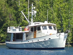
August 9 - 23: Sullivan Bay - Pender Harbor
Following Jennis Bay we spent a single night at Sullivan Bay then moved on for two nights with our friends at Kwatsi Bay. Sunday we fished for crabs at Viner Sound and for prawns in Laura Cove on Monday. Did pretty well in both places. Tuesday and Wednesday we hit Pierre's for the prime rib dinner then moved on to Lagoon Cove Thursday.
This area was first explored in the early 1790's by both the English and the Spanish. George Vancouver and William Broughton captained the HMS Discover and Chatham while Galiano and Valdes were aboard the Sutil and Mexicana. They encountered each other frequently and even shared the same anchorage on occasion. Nearly all the place major place names stem from these vessels. These early explorations were driven by trade possibilities but it was logging and fishing that brought more permanent settlers beginning around 1870. Small farms also began to sprout at about the same times. In a few places you can still find the remnants of their orchards. These men often rowed, rowed, 200 miles to Vancouver for supplies and to conduct business. A tough living. By 1892 the Union Steamship Company was making regular stops at the camps, canneries and mills.
Shafted in Lagoon Cove: We had no sooner tied up to the north dock at Lagoon when Bill asked us to move to the south dock because M/V Dearleap was on its way and Bill needed the space. Dearleap is a 100 foot, 83 year old, wooden fantail yacht. It is a common sight in these waters.
We slowly pulled a way from the dock and eased into a big "U" turn. As we coasted to the south dock I reversed gear only to hear a God awful clatter and banging from the aft of our boat. I thought we had caught something in our prop but I couldn't imagine what it could be. Forward gear resulted in the same noise. A couple of dinghies then hustled out and pushed us into our slip. A glance over the stern revealed nothing in the prop but a look in the engine room was a different story. The propeller shaft is joined to the transmission by two flanges attached by eight bolts. Four the bolts had failed and the propeller shaft was hanging by the remnants one remaining sheared bolt. The clattering was the propeller shaft flying around. The two flanges are separated by a "Polyflex" coupling which was installed about five years ago when we also installed new engine mounts. The whole assembly looks something like this.

The "Polyflex" is a disk of heavy plastic about 4" in diameter and an inch thick. It is attached to the transmission shaft by 4 bolts and nuts. The propeller shaft is then joined to the "Polyflex" by four more bolts threaded into "nuts" which are imbedded into the body of the "Polyflex" coupling itself. The whole thing is designed to reduce stress on the transmission. It is also supposed to dampen vibration some. Well, we had not hit anything and we had just completed a four hour trip from Pierre's.
I had noticed slightly more wobble in the shaft lately and made a note to have the shaft/engine alignment checked when we haul out for bottom paint in a couple of weeks. The disk was still attached to the transmission shaft properly but three of the prop shaft bolts had sheared off and the remaining bolt had pulled its imbedded nut out of the coupling. I theorize the following. The coupling failed* over time causing a crack adjacent the imbedded nut that later pulled out. The weak spot caused continual flexing and weakening of the other tree bolts until another failed thus creating even more stress on the other two which sequentially failed too. When we were in forward gear the prop thrust continually pushed the sheared bolts into their respective flange holes keeping them engaged. But, when we shifted into reverse the prop caused a pulling force and yanked the prop shaft flange away from the coupling. That's when the imbedded nut pulled free as well.
 |
| The Culpert |
*Anderson's Second Nautical Law - All things nautical are in the process of failure.
Friday: We made an easy 4.5 hour hike down Johnstone Straits to Forward Harbor where we tried for more crabs. But, the commercial guys beat us there so all we got were smalls and females.
 |
| The Tug Moved the Raft So We Could Exit Forward Harbo |
By mid-afternoon we were at anchor just off the little government dock in Shoal Bay. After dropping the anchor I shortened the scope to about 3-1 because I did not want to interfere with boats at the dock. I set the anchor alarm for a radius only 120 feet. There was a little breeze from the east so we were stern to the dock with our anchor pulling up the slope of the bottom (That's why they call it Shoal Bay - the water is deeper in the center of the bay but near the shore it gets shallow (shoals) rapidly.) During the night we heard the anchor chain growling over the rocks on the bottom - a common sound. At about 03:00 the anchor alarm sounded - also a common occurrence when on a short alarm radius. Rolynn got up to check and found all the lights and other boats where they should be. About an hour later she checked again and all was good. At about 07:00 she got up to begin writing, her morning ritual. She soon nudged me awake and calmly said, "Um Steve, we are adrift in 330' of water." Sure enough we were in the middle of Calm Channel with 150' of anchor line hanging straight down. The water was so calm we hadn't detected any movement. We should have figured this out when we no longer heard the chain growling. Anyway, we started the engine, winched in the anchor and sneaked back into the bay hoping no one had noticed our "departure".
During the night the breeze had shifted to the west, away from the dock. So, the angle between the anchor rode and the bottom increased dramatically, lessening its holding power. We drifted away from the shore until the anchor just fell off the slope of the bottom and we were officially adrift. We were in little danger of grounding because the anchor would likely have caught again in shallower water. Its the first time in probably 1000 anchorings that we have drug.
At about 10:30 Sunday, we left, again. We needed to transit the first rapids at Dent before slack in order to have enough time to make it through the fourth rapid at Hole in the Wall after slack. Hole in the Wall is one of three entrances into the Octopus Islands Marine Park. All of the entrances have rapids so getting into the park can be challenging because all of these rapids are preceded by others which also require timing. On spring tides, like this, it is hard to hit them all in a slow boat like ours, especially coming from the north, as we were. By the time we got to Hole in the Wall the current was running 5-6 knots against us but is was not too difficult. It is actually easier to run against the current, within reason, than with it since the water runs faster over the ruder allowing for better steerage.
Monday: Octopus Islands is a pretty complex of rocks and islands that is a popular anchorage. We were there to meet up with old friends of Rolynn's from her Juanita High School days. The five of them had chartered Black Swan a 52' Grand Banks and it was there first day. They pulled in about 13:30 after making the slack at Surge Narrows and, after a little maneuvering, rafted up to our starboard side. We helped with a few boat issues and spent a nice afternoon and evening with them. During the nice part we discovered that our generator decided that we were having too much fun so quit on us. It runs but will not produce electricity. It has happened before and I thought I knew the problem but I turned out to be wrong. (That's the third time - I was wrong in 1974 and 1986, too.) This will be item 31 on my "Boat Do List" when we get back. Anyway, we now have to proceed south by going from marina to marina or by anchoring for single nights after long runs which recharge our battery banks. That's OK because it does not present much of a change to our present plans anyway.
Tuesday: We cast Black Swan adrift and headed south through Surge Narrows to Lund which is a little community on the BC coast. It is far north as the coastal road goes. From here you can drive to the tip of South America. There is a small but nice marina, a couple of small but good restaurants, a store, and a great bakery. We have not been here for years and we like it so much we will stay two days then head south along the coast to Pender Harbor, then to Bowen Island in Howe Sound to meet up with friends who live in West Vancouver.
Thursday & Friday: It was a 5 hour run from Lund to Pender Harbor on the "Sunshine Coast". The tide and wind were behind us so it was a pretty smooth ride. Pender Harbor is actually a complex of islands, bays and coves studded with homes, condos and marinas. It has lots of room in the inner bay for anchoring, too, which we did. On Friday it was 5.5 hours to Snug Cove on Bowen Island in Howe Sound just north of Vancouver city. Again, the wind, what there was, and tide were going our way and it was a very pleasant ride. As is our habit, we listened to an audio book on the way to help pass the time.
We are here at the Union Steamship Co Marina on the south side of Bowen Island. It is a cool, artsy-fartsy, retro funk/hippie, cum nouveau riche kind of place. It is served by a ferry from Vancouver so it has long been a popular recreation and commuter destination for Vancouerites. It also has the world's best fish and chips at Doc Morgan's. As we were walking back from dinner we saw the coolest watercraft. It was an amphibious, ridged bottom inflatable with an outboard - about 20' in length. As the guy approached the beach he simultaneously lowered wheels for and aft (hydraulic, I think) and raised the outboard. The wheels had some kind of auxiliary power and he just drove it up the beach, across the resort lawn and into the parking lot. It must cost a bazillion dollars, but our beach combing friends would love it.
 |
| Amphibious Dinghy - Cool! |
 |
| Bow-Days Parade |
 |
| Wooden Boat Show at Granville Island |
 |
| Stephanie, Alan and Wyatt at Bowen Island |
Tuesday - We were up at 5:30 but it was too dark so we snoozed for another 30 minutes. By 06:30 we were pointed towards the straits and Porlier Passage, one entrance into the Gulf Islands. There was very little wind and we had a easy crossing. By 11:30 we were tied to a mooring buoy in Montegue Harbor. Tomorrow, we will make the 6 hour run to Anacortes. There, Rolynn's brother, Collin, and some of his work colleagues will meet us for an overnight cruise on Friday/Saturday. Later in September we will have a group of Rolynn's original Jackson High staff members for a day. The following week we will head over to Roche Harbor for the Krog-In, a rendezvous of sister ships.
 |
| The Welcome Committee at Anchor Cove |