Pages

"Intrepid" is a Kadey Krogen trawler style motor vessel built in 1987 at the Chung Hwa Boat Yards in Taiwan - hull 138 of 206. She is 42 feet in length with a beam of 14.5 feet and weighs 40,000 pounds fully loaded. Carrying 750 gallons of fuel and 240 gallons of water, she is capable of extended cruising. A previous owner cruised her from Annapolis to the Caribbean and Venezuela then through the Panama Canal, the Sea of Cortez and up the Pacific Coast to Alaska over a period of three years (She was then named "Carpe Diem"). We know of no Krogen that has traveled farther on her own bottom than "Intrepid". We purchased her in 1999 and live aboard her four months of the year as we cruise the intricate waters of the British Columbia and Southeast Alaska coasts. She is berthed in Anacortes, WA.

You can follow Intrepid's path at http://tinyurl.com/3mhj7gz

Check out the story about our grounding in Passagemaker's online magazine at http://tinyurl.com/cu7ar3u

Take a look at Rolynn's author website at http://rolynnanderson.com/RolynnAnderson/HOME.html

If you like technical stuff here is the article I wrote about building a watermaker that appeaared in Passagemaker's online magazine:
http://www.passagemaker.com/channels/watermaker-doing-it-yourself/

Friday, September 2, 2011

Homeward Bound - Shearwater to Anacortes:

August 11 to August 31 - Left Shearwater after two nights and headed to Fury Cove, a seven hour trip. This puts us in position to cross Queen Charlotte Sound tomorrow morning. We passed Namu, one of the old abandoned canneries that dot the coast. It was once a small town complete with stores and a hotel. The ability to ship fresh and frozen salmon by air helped kill the canneries. Even then, the bulk of canned salmon went to Great Briton and its colonies. Namu is now a ghost town. You can walk the docks, carefully because you might fall through, and see the machinery they left behind. Peer through the dirty windows into the office and see the ledgers and file cabinets still in place. A calendar from the early 1960s hangs on the wall. There is a caretaker on site. He's more of a squatter really. You might see a couple of old time gill netters tied to the dock waiting for the next opening. The moorage is cheap.

Fury Cove
It was calm and pretty at Fury. Its one of our favorite stops. We left Fury at first light, when the winds are lightest, for the crossing of QC Sound. Is was flat with only widely spaced rollers from the west - less than one meter. We dropped anchor in Blunden Harbor about noon. Blunden has room for many boats and was once the site of a First Nations village. Only the tell tale miden of white shells remains. It is a favorite spot for the beach combers to crawl around looking for the few remaining trade beads.

Saturday we completed the trip to the Broughtons by pulling into Sullivan Bay Marina. Sullivan Bay is a long established marina and complex of summer homes all on floats. There are about a half mile of docks. Many of the homes are surprisingly large and some have even larger boats parked in front. If you peak around the back of the houses you may see a float plane tied up. There is a helicopter on the roof of one house. We stayed two days and met up with Suzie and Mike Miner aboard "Seeker". They live near us in California. The store bought several of Rolynn's books for resale.

We continued the "grand tour" by heading to Pierre's at Echo Bay but we first stopped off for one night in pretty little Laura Cove where we pulled up about 80 prawns. At Pierre's we sat down for their Wednesday night prime rib dinner. A complete dinner with all the trimmings for $30. It's a good deal. Rolynn made a little pitch to the 80 or so in attendance and there was a run on her book. The store ended up selling 20 of them. We stayed through the pig roast on Saturday night then headed to our favorite stop - Kwatsi Bay.

Kwatsi is a small marina run by Anca and Max and their two teenage kids. We have known them for about 12 years now and they have become good friends. Its always fun to catch up with them.

After two nights at Kwatsi it was on to Lagoon Cove. Bill Barber and his wife Jean have run the place for 19 years now. Bill is 77 and hops around like he's 40. Lagoon Cove has been here since the early 20s. There were once 5000 loggers and fishermen living in the area. The store around the corner, now gone, once sold more beer than any place in BC except one.

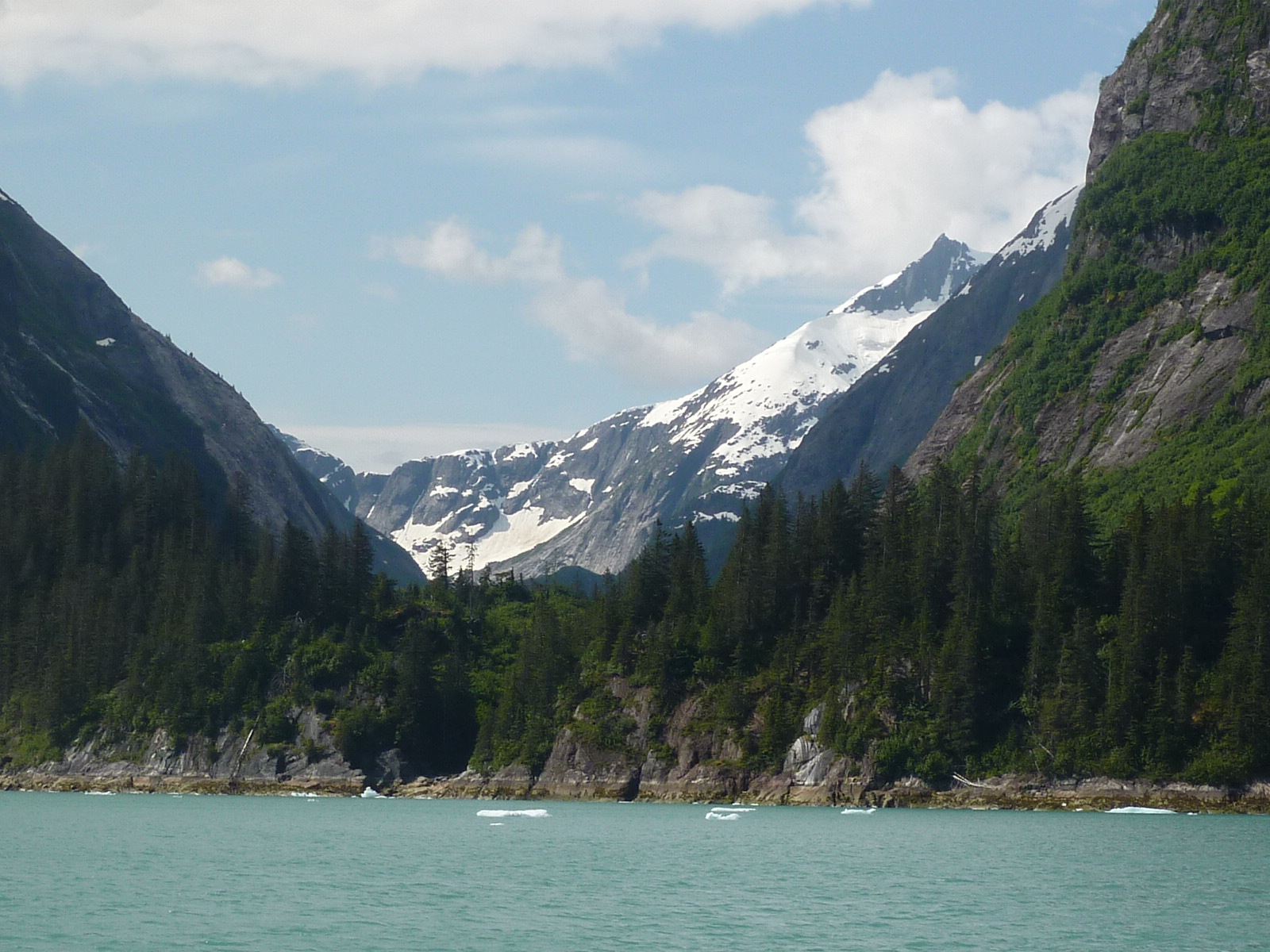
Orcas in Johnstone Staits

The next day was a short trip to Port Harvey, on the cusp of Johnstone Straits. Port Harvey Marina is a new facility - only three years old. They are struggling and we like to support them if we can. It was looking like the following day would be a good day to head down the straits and that proved to be true. A good tide, sun and a light following breeze brought us to Hemming Bay on Nodales Channel - a new stop for us. Its in a good location since it allows us to by pass two of the five tidal rapids that complicate this part of the coast.

Sonora Lodge
On the 26th we negotiated the rapids at Dent Island and tied up at the Stuart Island Community Dock in Big Bay, the site of "Last Resort". Rolynn pow wowed with the store manager who wants to stock the book next season. She also agreed to give copies of it, along with a letter from Rolynn, to the managers of the Sonora Island and Dent Island Resorts. We could have gone to dinner at Sonora Island for only $195 each.

Saturday we left at 09:45 to time the Yuculta Rapids and then spent a sunny four hours motoring to Cortes Day where we anchored at about 13:00. There are several homes here as well as outstations for the Seattle and Royal Vancouver Yacht Clubs. I winterized the dinghy while Rolynn worked on marketing ideas for her book. It looks like light winds tomorrow so we will be up at 05:30 to listen to the weather then we will probably head down The Straits of Georgia to Nanaimo - about a nine hour drive.

Night Time Nanaimo
It was an easy 8 1/4 hours to Nanaimo - we had a good current. We pulled up behind Newcastle Island in a designated anchorage. Its named after Newcastle, England, because there used to be coal mines on the island. ("As useless as hauling coal to Newcastle") it was a beautiful afternoon and evening as we listened to western music coming from a concert in the park across the harbor.

Area Whiskey Gulf: On a chart of the Straits of Georgia, north of Nanaimo, you will notice a large five sided polygon marked "WG", about 150 square miles in area. It lies on the direct route to the opposite side of the straits. In radio talk it is referred to as area "Whiskey Gulf". The chart will also tell you that the seabed within the area is 1200 feet deep and is as flat as a billiard table. It is a military exercise area in which the Canadian and US navies test torpedo guidance systems. On the seabed lie an underwater network of sensors joined by cables to a control center on nearby Winchelsea Island. The torpedoes are fired from range vessels along a predetermined course and tracked from the control center. After a run the torpedoes pop to the surface and are retrieved by helicopter or range vessels. The area is closed to transit a few days each week while testing occurs. The status of Whiskey Gulf is broadcast over VHF radio on the Coast Guard and weather channels. If you wander into the active area you will hear from the control center who will inform you, in no uncertain terms, to make a bee line out of the area. They insist that you take the most direct course regardless of wind or sea conditions. If you don't respond you will soon have a helicopter hovering over your boat. Ignore the helicopter and you might have a gunboat show up. Whiskey Gulf was not active during our crossing so we did not have to negotiate our way around it.

Dodd Narrows - Nanaimo
Monday morning found us having coffee in the sun on the back deck. Soon after we tossed off the line to the mooring buoy and headed for our 10:00 appointment with the currents at Dodd Narrows. Dodd can be a little bit of a zoo with so many boats trying to get though a 30 minute, or so, window. That's especially true now that we are approaching Labor Day with lots of boats are heading home for the start of school. There is also a large paper mill just south of Nanaimo, near Dodd. Paper mills need wood. So, there are large tugs pulling log booms or barges full of wood chips, either hundreds of feet long, that you might need to maneuver around to get to the narrows which, by the way, has a partially blind corner. To facilitate communications there is a standard practice in such passages. On VHF channel 16, which all boats are to monitor, we announce, "Securite', Securite', Securite'. This is the 46 foot motor vessel Intrepid south bound in Dodd Narrows. Concerned traffic please respond on channel 1 - 6." If everybody does this then you have a good idea of who's coming and how to take turns.

Telegraph Harbor - Thetis Island
By 13:00 we were tied up to the little marina in Telegraph Harbor on Thetis Island. They have old fashioned milkshakes here. Yes, we did.


Montegue Boats on Radar

Tuesday brought us to Montegue Harbor, only 2 1/2 hours away. Montegue is a large and well sheltered harbor on Galiano Island. There are lots of mooring buoys and room for many more boats to anchor. We tied up to a buoy and the park ranger came around in his dinghy to collect the $12 fee. The following morning we set out for Anacortes, 5+ hours away.

We crossed the US/Canadian border in Boundary pass where we cleared customs via the phone. We have NEXUS cards which give us expedited clearance without having to go to a customs dock. To get the cards we had to appear for an interview in the customs office in Seattle and have our finger prints and eye scans taken. One side benefit is that we can clear customs in airports by scanning our passports in a kiosk thus skipping right to the front of the lines. We are going to Baja in October so we can't wait to try it out.

"Olympus"
As we left Monegue we saw the M/V "Olympus", an historic and well know yacht in the PNW. She was built in 1929 and is now owned by one of Rolynn's former students. She is a divorce attorney.


Pole Pass

We entered the San Juans via Pole Pass, a narrow passage between Orcas and Crane Islands. It is so called because the indians used to catch birds there using cedar bark nets raised on poles.

We have had a wonderful trip with no unpleasant surprises. The boat ran well and our DIY desalinator made abundant, crystal clear water. We saw spectacular vistas, intimate anchorages, unique boardwalk towns and more wild life than we could have imagined. We returned to Anacortes on our 111th day of cruising. We reached 59 degrees north latitude, about 811 nm as the crow flies. We burned about 850 gal of fuel and covered 2705 nm of water in 378 hours of running time. That's 3110 statue miles - roughly the equivalent of driving to central Nicaragua at 8 miles an hour.

We'll go again.

Tuesday, August 9, 2011

Heading South - Petersburg to Shearwater:

We are beginning our trek south from Alaska but first a couple of more notes about Petersburg, our favorite town in SE.

There was once a tavern in town, well loved by the older residents. It was open from 1910 until about 1951 - "The Bucket of Blood". It is said you could see just about anything there, even if you didn't want to.

The harbormaster's office here has hundreds of black and white photographs of the old fishermen and their boats. As I was studying them I noticed, tacked to the wall among them, a small package of beans. The label read:

Norwegian Bubble Bath

Instructions: Cook and eat one hour before bathing.

Just in case you want to try that.

Saturday - July 30: We waited until 12:30 to depart in order to time the currents in Wrangle Narrows to our best advantage. After an uneventful five hours, or so, we pulled up to the dock in front of the Stikine Inn, in Wrangle, where we had dinner and stayed on the dock for the night.

This is Sunday, July 31, our 40th anniversary. Congratulations to us! .We celebrated by pulling away at 08:30, headed for Meyers Chuck, about 7 hours away. There are 21 residents of Meyers Chuck, according to the 2000 census. They have a post office. Mail is picked up at 1:00 PM on Thursdays. When the postal officials first showed up they asked an old fisherman living in a cabin the name of the place. "Chuck" he replied. "Chuck" is a native word meaning small bay or cove. They asked him his name. "Meyer", he said. After negotiating Zimovia Narrows we headed into Earnst Sound in placid water. We could now hear the weather forecast for Dixon Entrance and it looks like a good window is developing for Tuesday/Wednesday. So, we decided to skip Meyers Chuck and keep going to Ketchikan. After a 12 hour day we tied up in the Thomas Basin docks in downtown Ketchikan at 20:00. We will stay Monday night and hope for good water for Tuesday and Wednesday.

Monday afternoon we had drinks and snacks on board with Vic Kuceria, another Krogenite, who lives aboard here in the summer months. He has just published a history of the logging industry in Onalaska, WA. He and Rolynn swapped writer's laments and tips. Nice man and we had a good time.

West from Kah Shakes Cove
Tuesday, AM, the water was great and we set out for Kah Shakes Cove, a midway point on the way to Prince Rupert. Kah Shakes is a skinny entrance but pretty. We enjoyed a calm and quiet afternoon and evening.

Fox Names: Fox island, Fox Cove, Fox Creek, Fox Rock, Fox Point, Fox Lake, Fox Meadow, Fox Mountain, Fox Peak, Fox Bay, Fox Spring. What's with all the "Fox" names in Southeast Alaska?

High fur prices following World War I made raising foxes economically attractive. A new industry was born. Islands were much in demand for use as fox farms because the animals could run free. It was believed that wild animals produced better pelts than pen-raised animals. Blue fox was the species usually raised in Alaska.

During the decade after the war three-fourths of Alaska's fox farms were on Southeast Alaska islands. Nervous and shy, especially in breeding season, the foxes adapted well to the seclusion which islands offered. Nearby canneries provided cheap food in defective cans of salmon and scraps of fish. The animals also preyed on wild birds and their eggs.

Fox-farming did not require much capital. A fox farmer could lease an island from the U.S. Forest Service for as little as $25 a year. One or two pair of faxes was enough to stock an island if the farmer could subsist for two or three years while the brood stock multiplied.

By 1920 many fox farm sites had been leased in the Tongass National Forest. Many fox farm operators built cabins on the islands and lived in them. Others visited the islands only to distribute food and skin their furs. The worldwide economic depression of the 1930s destroyed the fledgling industry when the price of furs dropped. The only thing that remains of the fox farms are the names.

Green Island Light - Dixon Entrance
Wednesday dawned clear and calm when we pulled up at 05:30. We dodged about 30 gill netters as we approached Dixon Entrance. The water was a flat as a mill pond for the entire seven hour trip. After clearing customs we tied up at the Prince Rupert Yacht Club next to Dave and Donna Gibler, aboard "Seacat, another Krogen from Anacortes and Pacific Saphire, Krogenites from Vancouver, BC.. We enjoyed Cow Bay, the old part of Prince Rupert where the marina is located. It is named such because a Swiss dairy farmer shipped in a barge load of dairy cattle about 1916, so cows are the theme. There is Udder Bags (purses), Cowpucccoino's (an excellent coffee shop), The Cow Bay Café, etc. We had dinner with the other Krogenites at the Cow Bay Café. It sits fewer than 20 people so everything is prepared personally by Adrienne, the owner/chef. It was one of the five best restaurant meals we have ever had.

Friday - We were off for Baker Inlet in Grenville Canal, about 5 hours south of Rupert. We (Steve) misread the current tables so we arrived two hours after slack for Watts Narrows, the entrance into Baker. We sat off Watts and checked it out with the binoculars. It was a neap tide and the water did not look too bad so we went through. The channel is wide enough (150') and the shores are steep to, ie, deep right up to the shores. The inflowing current was only about 3 knots so it was easy enough. We put out s shrimp pot on the way in and a crab pot at the head after anchoring. We are only going about 3-4 hours tomorrow so we will leave on the afternoon slack, around 13:00. That gives us a quiet morning and the pots a chance to soak a while.

Fishing Bear - Verney Falls
Saturday - We pulled pots on our way out of Baker - only one keeper crab but about 80 nice prawns. Five hours later we parked in Lowe Inlet in front of Verney Falls to watch the bears fish for the Coho heading up stream. There is a sail "boat" anchored here which we saw in Prince Rupert, the "Ethereal" - all 191 feet of her. We saw two plane loads of guests arrive for her later in the PM. Rolynn made prawns alfredo for dinner. Wonderful.


Khutze Valley
Sunday - pulled up at 7:30 for a flat five hour run to Khutze Inlet in Princes Royal Channel. This is a new spot for us. We dropped pots on the way in and anchored in front of a beautiful waterfall around 14:00. It has no name but it is one of the five nicest falls we have seen with its multiple pools and branches. It could have stared in a movie like Jurassic Park or Shangri-La. It was a warn, beautiful afternoon and evening.

Monday/Tuesday - Got skunked on crabes and caught 200 strange looking "spider shrimp". We've seen a few of these before but never in these numbers. Don't know what the real name is but there is nothing to keep. So,on south down Finlayson Channel, through Jackson Passage and Narrows to Rescue Harbor for the night. Then to Shearwater where we will stay two nights while Rolynn catches up on publishing and marketing work. Weather looks good for a crossing of Queen Charlotte Sound later in the week so we will work farther south to Green Island Anchorage or Fury Cove to set up for a crossing on Friday or Saturday. The next post will be from somewhere in the Broughtons.

Thursday, July 28, 2011

Sitka to Petersburg

While in Sitka we celebrated Rolynn's birthday #XX so we had dinner at Ludwig's Bistro, the nicest place in town, but not the cheapest. I had seafood paelia which was GREAT. Rolynn enjoyed her prawns and lamb chops as well. Ludwig's only sits about 20 people. At the table next to us were eight nice folks from Alabama who were beginning a week's cruise on a charter boat. We departed on Thursday, June 21, after four nice nights, bound for Schulze Bay at the western end of Peril Passage. It was a short, 3.5 hour trip in good weather. The currents at Sergius Narrows were such that we would have needed to leave very early to make the narrows and go farther the same day so we decided to position ourselves close to Sergius for the following day. It makes a 7 hour run from Schulze to Ell Cove a reasonable day.

It was clear and calm when we left Schulze but by the time we got to the eastern portion of Peril, where it widens out and faces into Chatham Straits, it started to get snotty. So, what to do? We could continue on for 5 hours to Ell Cove but if it was unpleasant in Peril then Chatham, which runs north-south and opens into the Gulf of Alaska, would probably be worse. We're retired - the whole point is to have fun without a schedule. So, we turned into Appleton Cove and anchored in the same spot we had the week before. Appleton is nicely protected but the wind still blew pretty good and there were whitecaps in the anchorage well into the late evening. We were glad we didn't go any farther.

The Waterfall Coast:
The east coast of Baranof Island is sometimes called the Waterfall Coast and there are some nice ones. A few are right on the coast and a bunch more are inside the many coves and bays. Saturday we left Appleton around 07:30 for a 5 hour run to Ell Cove which is located on the northeast coast of Baranof Island. It was sunny and flat calm all the way to Ell Cove. If you didn't know Ell was there you would never find it. The entrance is invisible until you are in it. There is good water (deep) all the way in but there is a 90o right turn into the inner cove, hence its name, Ell Cove. The cove is nearly circular with 40 feet or so or water all the way to the shore - room for 3 or 4 boats without shore tying. Very pretty spot, well shielded from all winds. Later, we toured the cove in the dinghy and went around the corner from the entrance to see majestic Kasnyku Falls which is about 500 feet high.

How to See a Waterfall from Your Dinghy
1) Anchor big boat in picturesque cove nearby waterfall,
2) Climb ladder to upper deck where dinghy is secured,
3) Remove dinghy cover,
4) Discover a foot of water in dinghy,
5) Start dinghy bilge pump,
6) Discover dinghy battery is dead (from pumping water out),
7) Fold dinghy cover,
8) Climb down ladder,
9) Go to pilot house to get bungee cord to wrap dinghy cover,
10) Climb up ladder,
11) Wrap and stow dinghy cover,
12) Remove crab pots from dinghy,
13) Remove shrimp pot from dinghy,
14) Remove crab and shrimp pot line reels from dinghy,
15) Remove ditch bag, with flare kit and repair kit, from dinghy,
16) Remove hoist bridle form dinghy,
17) Open flare kit, pour out water,
18) Open repair kit, pour out water,
19) Climb down ladder with sodden flares and repair kit,
20) Climb up ladder,
21) Remove flybridge cover,
22) Open port storage compartment for access to battery charger,
23) Climb down ladder to pilothouse,
24) Open porthole in pilothouse,
25) Climb up ladder,
26) Pass extension cord for charger through porthole,
27) Climb down ladder,
28) Plug in extension cord,
29) Climb up ladder,
30) Remove battery box cover,
31) Discover water in battery box,
32) Climb down ladder,
33) Get drill from pilothouse,
34) Climb up ladder,
35) Climb down ladder,
36) Get bit for drill,
37) Climb up ladder,
38) Drill hole in battery box to drain water,
39) Climb down ladder,
40) Stow drill and bit,
41) Climb up ladder,
42) Attach battery charger to battery,
43) Start charger,
44) Remember you unplugged cord to get drill,
45) Climb down ladder,
46) Plug in cord,
47) Climb up ladder,
48) Repeat step 43,
49) Observe fuel hose is disconnected from fuel tank and laying in water,
50) Wonder if there is water in fuel hose,
51) Wonder if there is water in fuel tank,
52) Disconnect fuel hose from outboard,
53) Climb down ladder,
54) Blow fuel and water(?) from fuel line,
55) Clean fuel and water(?) off deck,
56) Climb up ladder,
57) Reattach fuel hose to outboard and fuel tank,
58) Climb down ladder,
59) Wait for battery to charge,
60) Replace sodden flares, dry and replace other contents,
61) Dry and lube repair kit contents,
62) Dry ditch bag,
63) Stow new flares and repair kit in dry ditch bag,
64) Climb up ladder,
65) Pump water out of dinghy,
66) Mop remaining water from dinghy,
67) Disconnect charger,
68) Climb down ladder,
69) Unplug extension cord,
70) Climb up ladder,
71) Stow Charger,
72) Cover flybridge,
73) Stow ditch bag in dinghy,
74) Lower boom,
75) Unsecure boom stays,
76) Bang knee on boom support,
77) Raise boom,
78) Remove flybridge cover,
79) Retrieve hoist control,
80) Lower hoist cable,
81) Reattach hoist bridle to dinghy,
82) Bang head on hoist cable weight,
83) Hook hoist cable to bridle,
84) Raise dinghy with hoist,
85) Lower dinghy with hoist,
86) Remove cable that holds dinghy to deck,
87) Stow hold down cable,
88) Raise dinghy with hoist,
89) Lower dinghy with hoist,
90) Climb down ladder,
91) Remove "down spout" from scupper so dinghy can clear side,
92) Climb up ladder,
93) Raise dinghy with hoist,
94) Lower dinghy over port side with hoist,
95) Climb down ladder,
96) Unattach hoist cable from dinghy bridle,
97) Pull dinghy to transom,
98) Pull dinghy back to port side,
99) Tie dinghy to port side,
100) Open aft curtains,
101) Roll up aft curtains,
102) Open transom door,
103) Untie dinghy,
104) Pull dinghy to transom,
105) Tie dinghy to swim step,
106) Climb up ladder,
107) Raise hoist cable,
108) Lower boom,
109) Secure boom stays,
110) Raise boom until stays are taut,
111) Stow hoist control
112) Cover flybridge,
113) Climb down ladder,
114) Climb into dinghy,
115) Climb out of dinghy,
116) Retrieve dinghy key from pilothouse,
117) Climb into dinghy,
118) Hope there is no water in fuel tank,
119) Crank outboard,
120) Repeat step 119 as needed or until battery is dead,
121) Pump fuel bulb to pressurize fuel line,
122) Repeat step 119,
123) Climb out of dinghy,
124) Retrieve PFD,
125) Climb into dinghy,
126) Climb out of dinghy,
127) Retrieve hand held VHF radio,
128) Climb into dinghy,
129) Climb out of dinghy,
130) Charge battery in VHF,
131) Climb into dinghy,
132) Test motor at high idle,
133) Untie dinghy painter,
134) Tie dinghy painter,
135) Climb out of dinghy,
136) Retrieve VHF,
137) Climb into dinghy,
138) Untie dinghy painter,
139) Slowly motor away from boat,
140) Discover steering is frozen,
141) Shift to neutral,
142) Look for anything blocking steering, observe nothing,
143) Paddle back to boat,
144) Tie painter to swim step,
145) Shut down outboard,
146) Climb out of dinghy,
147) Take off PFD,
148) Drop VHF on deck, wonder if now broken,
149) Test VHF,
150) Retrieve wrench from tool box,
151) Climb into dinghy,
152) Climb out of dinghy,
153) Get correct size wrench,
154) Climb into dinghy,
155) Remove fuel hose from outboard to gain access to steering controls,
156) Begin to disassemble steering controls (If wrench falls in water see step 153 or skip to step 158)
157) Climb out of dinghy,
158) Get another wrench,
159) Climb into dinghy,
160) Complete disassembly of steering controls,
161) Climb out of dinghy,
162) Retrieve lubricant,
163) Climb into dinghy,
164) Lube steering controls,
165) Reassemble steering controls,
166) Test steering controls,
167) Gather wrenches,
168) Climb out of dinghy,
169) Stow wrenches,
170) Climb into dinghy,
171) Discover lube,
172) Climb out of dinghy,
173) Stow lube,
174) Climb into dinghy,
175) Start outboard,
176) Climb out of dinghy,
177) Don PFD,
178) Climb into dinghy,
179) Climb out of dinghy,
180) Retrieve VHF,
181) Climb into dinghy,
182) Untie painter,
183) Motor slowly away from boat,
184) Test steering,
185) Motor in circle around boat - two directions,
186) Motor at higher speed,
187) Restart outboard,
188) Repeat steps 187 and 186,
189) Reattach fuel hose to outboard,
190) Repeat step 121,
191) Repeat step 187,
192) Motor to waterfall and back,
193) Tie dinghy to swim step,
194) Shut down outboard,
195) Climb out of dinghy,
196) Remove PFD,
197) Climb into dinghy,
198) Retrieve VHF,
199) Climb out of dinghy,
200) Stow VHF,
201) Climb into dinghy,
202) Retrieve ignition key,
203) Climb out of dinghy,
204) Stow key,
205) Mix Gin and Tonics,
206) Enjoy Gin and Tonics.

Sunday morning we noticed a little breeze in the cove but we can not get the weather broadcast inside. We were pulling the dinghy behind as we motored around the elbow, with the intention of going to Red Bluff Bay, and saw good sized whitecaps in the straits. By the time we turned the corner and headed south into Chatham we were bouncing around pretty good - and the dinghy was unhappy as well. We could now listen to the weather. Guess what? They predicted south wind 10 knots, seas 2 feet or less. OK, what are the choices? 1) Go back to Ell Cove, 2) Go five hours to Red Bluff Bay, dinghy in tow, and hope it gets better, 3) Go one hour to Takatz Bay, anchor and put the dinghy on top then continue 4 hours to Red Bluff, 4) Go 1.5 hours to Warm Springs Bay or, 5) Some combination of the above. We opted for going into Takatz and anchoring for the day. (See "retired - no schedule" above). There was no advantage to going on to Warm Springs since it is only an hour closer to Red Bluff. (We had not intended to use the hot baths, anyway.) But, this does put us a day behind or non-schedule so we may have to rethink Red Bluff and or Cannery Cove, our next intended destination. Later in the afternoon we dinghied out to the mouth of the bay to check the conditions in Chatham. They had not improved. We are here for the night.

Fogust:
July is nearly spent and we are approaching 'Fogust". The good thing about fog is there is usually no wind, to speak of. It lies thick along the shores of the islands in the morning but dissipates by late morning, usually. (Later in the month it is thicker and lasts longer.) In the afternoon the wind usually comes up. So, we move in the morning. Monday was heavily overcast with drizzle. Red Bluff Bay is reportedly very pretty with many waterfalls and high mountains. Another "cruising in Yosemite" kind of place. But, if it is overcast and raining then you can't see anything. So, we decided to cross Chatham Straits, round the southern tip of Admiralty Island and head to Cannery Cove in Pybus Bay on the SE shore for a couple of days. It is said there is good crabbing (although the commercial guys have picked off most of them, it seems.) and excellent halibut fishing. So, up at 06:30 to listen to the weather. The problem with the weather forecasts is that they are predicting for large areas, thousands of square miles, but the local conditions within an area vary widely. So, south winds 10 knots, seas 2 feet or less; they said. Not so, we say. Chatham was fine, visibility about 1/4 mile, but when we rounded Point Gardner, where Chatham Straits intersects with Frederick Sound, we found four foot "confused seas", ie, the waves came from all directions. We kind of tacked back and forth, trying to keep the waves off the beam but to little avail. We were never in any danger but it was uncomfortable, at times, and a few glass items, which should never be on a boat in the first place, were broken. Anyway, we made our way to Cannery Cove, put down a crab pot, and anchored in the rain. Admiralty Island has the highest concentration of Brown bears in Alaska. About one bear per square kilometer. There are many more bears than people here. Pybus Bay is very pretty, they say, but you couldn't prove it by us since we can't see through the mist.

OK, after two nights in the rain in Cannery Cove we are ready to leave. While, the weather forecasts (?) looked dicey we left at 06:00 Thursday. We pulled up the crab pot and got two nice ones that I will clean under way, weather permitting. As we exited the cove the chop picked up a little but it was manageable. It is a three hour crossing of most open part of Frederick Sound and it was fine, for the most part. At times the wind driven waves were on the nose while the swells were on the beam but the swells were about 15 seconds a part which is fine for us. When they are close together and the boat's natural roll rhythm gets in sync with the swells that it gets uncomfortable.

Compass Nuts and Bolts
: When we rounded Point Gardner on our way to Pybus Bay I noticed that there was about a 23 degree difference between our heading and our course, unusually large. A word of explanation. (Note, if you start to glaze over you have permission to skip this part.) The navigational program we use reports, among other things, the boat's Course, Bearing and Heading. The course is where the boat is actually going, the bearing is where you want the boat to go and the heading is where the boat is pointed; all in degrees of the compass. I tell the computer where I want to go (bearing), it gets the actual direction (course) from the GPS (Global positioning Satellite) and it gets the direction in which the boat is pointed (heading) from the autopilot's flux gate compass (electronic). In a perfect world (no current or wind) all three will be the same. But, there is wind and current, sometimes a lot. So, the autopilot compensates for the effects of wind and current by constantly monitoring the course and changing the rudder angle, via a motor. In other words, it constantly steers the boat (adjusts the heading) in a way that makes the bearing and course nearly the same. So, the heading is usually different than either the bearing or course. The difference is usually only a few degrees but we have seen it as high as 45 degrees when a strong current is directly on the beam, i.e., at 90 degreees to our bearing. We can tell if the heading makes sense by looking out the window. Do we see a landmark in front of the boat that is where it looks like it should be according to the computer screen?

When we were bouncing our way around Point Gardner the heading was bigger than the conditions (wind/current) called for and in the wrong direction. In fact, the heading error was always about 23 degrees to the east of our actual heading. OK, a little deeper into the weeds, now. (Although the following is fascinating, those who find it too abstruse may wish to enroll in Mr. Anderson's, 9th Grade Earth Science Class - Remedial Section) Not all norths are the same. "True North" is the geographic location of the north pole - the point around which the earth rotates (not revolves). The "Magnetic North" pole is the center of the earth's magnetic field and is a few hundred miles away (and it's getting farther) from the north pole. It is the direction a compass points. The difference, in degrees, is called the "variation". The farther north you are, the greater it is. Hereabouts it is 23.5 degrees east of true north. (Boat navigation is in reference to magnetic north, not true north.) However, there are magnetic anomalies, caused by the kind of rocks around, that make your compass act weird when you are in the area. But, they are pretty well known and shown on the charts. Besides, an anomaly would cause a differing amount and direction of error as the boat's heading changes. (Put a compass in the center of a board. Now put a magnet close by but off the board. Now rotate the board through a complete circle. How does the compass needle move? Remember there are two magnates, one of which is the earth.)

There are also things on the boat, electronic equipment, chunks of metal, etc; that effect the compass readings. This difference is called 'deviation". My compass error acted more like deviation than variation caused by anomaly. (Now put the magnet on the board with the compass. Rotate the board. How does the needle behave, now?) The error was always in the same direction and close to the same amount. Nothing on the boat had been changed - no new equipment, etc. Was something wrong with the flux gate (read expensive) compass? An unhappy prospect, to say the least.

The compass lives in a cupboard where we store snacks - chips, tostadas, nuts, etc. We have consumed some of them so the cupboard is no longer as tightly packed. A large can of peanuts had shifted position due to the rough seas and was now sitting next to the compass. Remove the peanuts and voila, compass error gone.

South from Petersburg:
OK, we are back in Petersburg so you can wake up now. Its July 28 and we are headed south covering, in reverse, much of the same territory we did coming north. Stands to reason. Rolynn is beginning a new book, a historical murder mystery, which is set in Petersburg so she will be doing some research here. We will hit Prince Rupert this time, to clear Canadian customs, and may go on the outside of Pitt Island, weather permitting, rather than retrace Greenville Canal. We will spend a couple of weeks in the Broughton's and should be back in Anacortes around Labor Day.

Wednesday, July 20, 2011

Juneau to Sitka

Skagway (June 27-29): We decided not to take the boat to Skagway. It is a long way up Lynn Canal to Skagway, about 70 miles each way. We would face at least two ebb tides, probably four. The canal runs north-south so if there is any south wind against an ebb tide the canal will turn snotty in a hurry - and there are very few places to hide. With as many as four ebbs the chances are too good (bad) that we would face unpleasant conditions. So, we scrambled to get ferry tickets, hotel reservations and White Pass train tickets and took a three day (instead of five in the boat) trip to Skagway.

We walked on the ferry at 06:00 and grabbed front row seats in the observations lounge for the seven hour trip up the canal. It was a beautiful day. We read, dozed, watched, worked, and listened to the on-board park ranger give his talks. It was very enjoyable. After we checked in to one of the tree hotels in Skagway (a B&B) we walked the boardwalks of town. Much of down town is actually owned by the National Park and they have a good museum about the 1898 Yukon gold rush. There was a world wide depression, the Panic of 1893, when gold was discovered on the Yukon River in the Canadian Klondike. More than 100,000 people rushed to the area. Doctors, lawyers and merchants as well as bums (like Jack London) flooded north. The mayor of Seattle resigned his office, in route. When they got here they were dismayed to learn that they still had 600 miles to go, much of it over either of two high mountain passes. Worried about a disaster, the Canadian Mounties established a check point at the summit - the boarder. They required each person to have at least 2000 pounds of supplies. So, the wealthy hired the local Tlingit to pack their supplies - at $1.00 per pound. The not so rich made 20-30 trips, single file, up steps carved in the ice to the summit. The other route was suitable for pack animals. Enterprising persons down south sent broken down horses to Skageway for top dollar rather than to the knackers. The horses promptly died on the pass. One location made famous by Jack London became known as Dead Horse Gulch. The spring revealed over 3000 carcasses. I've seen the pictures. After the summit they had to pack it all to Bennett Lake where they spent the winter building boats. When the ice broke up on the Yukon River they raced down the rapids to the gold fields only to find that all the claims had already been taken. The rush lasted only a year and only few got rich, and most of them were the folks who sold the miners their supplies or stole their money, like Soapy Smith.

White Pass Train
A few years after the rush a narrow gage railroad was built over the pass to Whitehorse. The train still operates and it is a dramatic trip up to the summit and back. The weather wasn't great but we had a good time. The following day we returned, via the ferry, to Juneau.


Upon our return to Auke Bay I discovered that my laptop had died. It would not power up. No lights, hums, blinks - nothing. That means that I can not access any data on the hard drive. Inquiries revealed that the power circuits in the motherboard are probably TU. So, the next day I took the bus to Costco to go computer shopping. I spent the remainder of that day and all of the next installing critical apps and downloading stuff. I got to a place that I can live with. When we return to Anacortes I will get a housing for my old hard drive so that I can retrieve my data.

Sunday morning we filled up on fuel (422 gallons at $4.29 per gallon. Do the math.) and took off for Glacier Bay.

July 2 - Auke Bay to Glacier Bay: We had planned to stop about half way to Glacier Bay but we didn't like the anchorage so we called the park and asked permission to come a day early. We had to ask because the National Park Service has strict regulations about entry into the bay. You have to have an advance permit. The park is the size of Connecticut but they only allow 25 boats, including cruise ships, in the bay at any given time and seven days is the maximum stay. That means there are only 3-4 new entries per day. Our permit started on the third so we had to ask permission to enter on the second. Fortunately, there was a cancellation so we were able to enter and anchor off the park docks. The following morning we attended the required orientation session where we were apprised of the various rules and area closures, all aimed at protecting the abundant wild life. The speed limit is 13 knots (Not a problem for us.) and we can not come within a mile of the shore if the channel is more than two miles wide. If it is less then we take a mid channel course. When approaching an anchorage we do so at 90 degrees. All of this is because of the humpback whales which are like mosquitoes here. They migrate here with their calves from Hawaii and Mexico to feed, which they do along the shore. They are sensitive to the noise of boats so keeping us slow and off shore is to their benefit. We must stay at least 0.25 miles away from them but they sometimes pop up closer. There are similar rules concerning the other marine mammals and birds.

Glacier Bay (the park is much bigger than the bay) is about 70 miles long and it is about 60 miles from the entrance to the northern most glaciers. When Captain Vancouver came by in 1794 the glaciers extended out into Icy Straits. When John Muir was here in 1879 he found the ice 40 miles up bay from Vancouver's charting. The maximum advance was around 1750, the end of the "Little Ice Age" which had lasted about 400 years. Now, only one of the glaciers is advancing. The others are either stable or retreating. This is big country. The Fairweather Mountains which comprise the peninsula that form the western side of Glacier Bay, have at least 18 peaks in excess of 10,000 feet with 6 over 12,000 including Mt. Fairweather at 15320 feet.

Fighting Bears - Blue Mouse Cove
Sunday - We anchored the first night in Blue Mouse Cove. 120 years ago we would have been under the ice. Around dinner time a Humpback and her calf entered the cove and made a couple of tours. The cove is relatively shallow so they stayed near the surface. The first time by they came within forty feet of the boat. The second time them came right at us then dived under the boat and came up on the other side. We tried to get pictures but they don't show much of themselves and you never know where they are going to surface. A little later two brown bears showed op on the beach. They soon approached each other and got into a scuffle. They got on their hind legs and boxed and growled. There were three rounds of action, each separated by periods of cautious rest. The second round took place in the water. By the third round they were like to heavy-weight Greco Roman wrestlers who knew each other's moves too well. In the end the larger won on a stalling call. Afterwards, they ambled off into the woods, side by side. I think they went to reminisce about old bouts and have a beer or two. Later, a park ranger said they were probably sibblings. Around midnight we heard a pack of wolves howling.

Reid Glacier
Monday, the Fourth of July, we are anchored in Reid Inlet about 1000 feet in front of our personal glacier. It is a terrestrial glacier (just barely) so it doesn't calve ice bergs into the water. We grilled steaks for dinner.

We awoke to low overcast and steady drizzle so we decided to stay put for a second day. Rolynn has a cold which she caught from me which I probably caught on the bus to Costco. We can't get any weather broadcasts up bay but the last weather forecast we got two days ago called for no rain tomorrow, the 6th, and we'd like a nice day to go Margerie Glacier. Besides, the same report predicts some wind and 4-5 foot seas in Cross Sound so we want to drag our feet a little and let that pass before we exit the bay.

"She's alive! She's alive , I tell you!" (Mel Brooks - Young Frankenstein)
Wednesday morning we awoke to mostly sunny skies as headed up Tarr Inlet to Margerie Glacier. Margerie is the most active of the glaciers in the bay, meaning large pieces of ice break off the face and fall crashing into the bay. We watched a cruise ship go in ahead of us and let her clear a path through the floating ice for us. As she vacated her parking spot in front of the glacier we took her place. She had swept a nice vantage point clear of ice. The sky was clear and there was not a whisper of wind. We drifted at about a half mile from the face and didn't move twenty feet in two hours. We are at 59o 03' N, the most northerly point of our journey and only a mile from the Canadian border. Margerie rises about 250 feet above the water with another 100 feet below. She is about a mile across the face and 21 miles long.

Margerie Glacier
It is like a living thing. It crawls forward about 6-8 feet a day. She is almost constantly make growling sounds. Every few minutes we hear what you would think are riffle shots or shotgun blasts in another setting. Some sound like dynamite. Every 10 minutes, or so, we first see, then hear, a house size chunk of ice plummet into the bay. The sound is awesome as the echoes reverberate between the mountain sides. I don't know anywhere in the world where one could duplicate the experience.

At 14:00 we pulled away and picked our way back through the bergie bits and headed for Russell Island for the night. The anchorage is a little open but the winds are calm and the barometer is rising so we think we will be OK here. If the wind comes up we can head around the corner and back to Reid Inlet only about 30 minutes away. That's the nice thing about being this far north. Even if we have to move at 02:00 there is still light.

Wednesday was a quiet night so we moved down bay to North Sandy Cove. Access to the shore here is prohibited because the bears have become too familiar with humans. We thought this might mean we would see tem along the shore but we saw only a small black bear in the distance. We left in the early Friday afternoon for Bartlett Cove where we took on water and anchored off the dock for the night.

Seine Boat in Icy Straits
The ABC Islands: We checked out from the park Saturday morning and headed west into Cross Sound towards the Gulf of Alaska. We are now heading into the ABC Islands, Admiralty, Baranof and Cichagof Islands. The trollers were out fishing and we saw humpback whales spouting and flashing their tails in every direction. There were so many that we could smell their breath down wind. One breached completely clear of the water about 500 yards in front of us. Later, we heard that a humpie had breached under a sailboat near Hoonah and broke the boat in two. The boaters were pulled out by fishermen. The boat was probably sailing without engines so the whale did not know it was there. Its best to make some noise. Leaving the depth sounder on is a good idea if you are not motoring. We also read an account of a boat from Sitka that was sunk at anchor by a whale while the owners were off in their dinghy. No one believed him until they found baleen stuck in a three foot hole in the hull.

We turned the corner into Lisianski Inlet and tied up at Pelican about 15:00. We had heard of Pelican for years - it is a boardwalk town, no streets. It is located at the edge of the Gulf if Alaska and its rich fishing grounds so Pelican had been the base of the local fishing fleet. Then, a few years ago the fish plant closed down and the fleet moved on. Now, most of the fishing boats in the harbor appear to be derelicts. It is sad. The town is slowly dying and the locals can't agree on how to adapt. We saw one sign on a house door, "I'd rather have a daughter in a whorehouse than a son on a cruise ship." We were disappointed in Pelican.

From Pelican we have the choice of heading west through Lisianski Passage then down the Pacific side of Chichagof and Baranoff Islands to Sitka or go back up Lisianski Inlet and circumnavigate Chichagof counter clockwise, staying out of the Pacific. We chose the later so we made the short run to Elfin Cove, another one of those places we have wanted to visit for years.

Elfin Cove Highway
Elfin Cove is even smaller than Pelican, 18 people last winter according to the postmaster, but it is doing better. It never depended on a fish plant so it is adapting. There are several fishing lodges here which seem to do an active business. There is also a post office, a surprisingly well stocked store and a decent restaurant. This, too, is a boardwalk town. The only vehicles are hand carts. The "main" boardwalk is actually an Alaskan highway and is maintained by the state. The walks and trails meander all over the cove. It is really quite charming. If you squint a little you might see Hobbits peaking from among the ferns. Like many of these small towns, Elfin began as a winter harbor for bachelor fishermen who lived on their boats. The winters are milder here, close to the Pacific, than they are at the mainland.

Fairweather Mountains from Elfin Cove
The weather has been spectacular here but they are calling for some wind so we will want and see about leaving tomorrow. "They" is the US Weather Service who's predictions are not very useful. They have a limited repertoire: Winds 10 knots, Seas 2 feet or less; Winds 15 knots, Seas 3 feet; Winds 20 knots, Seas 4 feet, Winds 25 knots, Seas 5 feet; etc. We have yet to see actual conditions anything like their predictions. It seems like they just want to be in a position to say, "We told you so." if you go out and get hammered. By "seas" they mean "Significant Wave Height (SWH)" - the average height of the highest 1/3 of the waves. So, a 6 foot sea is the average of the highest waves, some being higher. More precisely, 1 in one 1000 waves will be twice as high as the SWH. (This happens when two waves get in phase and double their amplitude.) So, if a wave comes by every 5 seconds in a 6 foot sea you will see a 12 foot wave within a couple of hours. So, pay attention out there.

Rolynn has done yeoman's (yoewoman's?) duty for parts of two days cleaning and reorganizing the engine room. She's done a great job that we have put off for a couple of years.

Downtown Elfin Cove
Last evening a large ship anchored nearby. She has a military or research vessel look to her - lots of cranes, a huge radar dome, helicopter, boats on deck, etc. She has a submarine, too. It turns out that she was built as a resherch vessel for Jacques Custeau but was sold to a hedge find mogul a few years ago who refitted her (5 years!) for his personal use. He is cruising around now with his friends aboard. His crew includes private fishing guides, naturalists, pilots, etc. When he is not using it he leases her out to governments, research institutes, etc. Last summer she was leased to the French government. They used her to find the Air France flight that went down in the Atlantic.

On the Tide Grid in Hoonah
Hoonah - July 13: A five hour cruise in modest seas brought us to Hoonah on the NE corner of Chichagof Island. It is the largest Tlinget community in SE. These Huna trace their history back 3000 years to Glacier Bay when they were forced to vacate that place due to the advancing glaciers.

The old cannery about two miles from town has been converted into a destination for cruise ships that sit across the bay and ferry in their passengers on life boats. So, we made the hike to Cannery Point. There is an interesting museum which shows the canning process as well as shops and eateries of various kinds. There are couple of examples of the "Iron Chink" which is a large mechanical wheel that cleaned the salmon. It replaced the Chinese workers who had been doing the work by hand on the "slime line". Its interesting that they never explain the origin of the name. Not PC, I guess. Also at the cannery is a mile long zip line that begins at the top of the mountain. It is actually five lines abreast. A rider its 60 mph on the way down. 92 seconds for $92. We passed.

When Alaska was federal territory the natives of the Hoochinoo tribe learned to make bootleg. They used steel drums to heat the mash and instead of copper coils to cool the vapor they used the hollow tubes from the stalks of bull kelp. That's the derivation of "hooch", among others.

In 1944 two women were smoking salmon under a house resulting in a fire which spread to the neighboring houses. It was also common practice then to store gasoline in barrels under houses. You can guess the rest. The fire spread in a series of explosions that destroyed the town. The chief of the clan to whom the women belonged realized his clan could never repay the damages so he gathered the clan's regalia (most prized ancestral possessions) around him and let the fire engulf him to pay the clan's debt.

We had debated about stopping at Hoonah but it was worth the stop.

Tenakee Springs Post Office
Wednesday and Thursday - Tenakee Springs: Tenakee is a metropolis - if had almost 70 residents last winter. There is a store, Snyder's Mercantile, that opened in 1899 and a little café. This too began as a winter harbor and it has the added attraction of a hot springs in the middle of town. (There are men's and women's hours - no clothes allowed.) Many of the summer residents are retired public employees from Juneau. Others just want to be left alone. In the café I chatted with a guy doing beading. He was a ringer for Jerry Garcia of the "Grateful Dead".

The Tennakee Mall - Snyder Mercantile
Friday morning we left for Appleton Cove at the entrance of Peril Straits, the main "highway" to Sitka. We will have to time the rapids at Sergius Narrows but it looks like we can get all the way to Sitka in one day.

In transit we were overtaken by the Fairweather, the fast ferry. It is a BIG catamaran (twin) hull with water jet propulsion. Her AIS (a system that broadcasts a boat's location, heading, speed, etc) showed her at 38.2 knots, almost 45 mph. We got out of the way! We meet her again in Neva Strait as she was leaving Sitka. There wasn't much room for us to move to the side but she was only going at 18 knots because of the narrow channel.

We arrived in Sitka around 16:30. Krogen friends, Norm and Pat Wade, who reside here in the summer, met us at the dock and we had a nice chat. We walked toward town and made reservations at Ludwig's for Rolynn's Birthday dinner but we had fish and chips elsewhere.

Monday - Today was devoted to boat jobs. It's raining so we might as well. I changed oil (five gallons) and filters. We've put on 235 engine hours since we left Anacortes, the equivalent of about 10,000 auto miles, so its time. There is an oil recycle dump at the top of the dock ramp. Unusually convenient. Rolynn worked on her latest novel and also the marketing of "Last Resort". She had a calamity a couple of days ago. Even though she backs up she lost a week's worth of work on her present book. We also made a trip to the grocery store in the rain.

Sitka - Totem Pole Park
Sitka is a derivation of the native name "Shee Atika" - the people who live on the side of Shee (Baranof Island). The Tlingits who lived here were a prosperous people because of the many food sources available. Also, the Japan Current runs off shore which keeps the harbor ice free year around so the natives weren't forced relocate seasonally. These factors allowed for a stable population and the free time to commit to art and crafts. Baranof was the manager of the Russia-America Company. He talked the Czar into giving his company exclusive trading rights based, mostly, around sea otter furs. He built a post here (ice free) in 1799, hence the Russian heritage of the area. There are about 8000 residents now and about as many commercial fishing boats, it appears.

Saturday, June 25, 2011

On the Road Again: Ketchikan to Juneau

We returned to Ketchikan from Seattle on Sunday, 6/13. Dave and Linnea Mattson were great hosts. They ferried us to and fro from SEATAC and to the event in Everett. That plus a great dinner and two wonderful breakfasts. They are great friends.

The trip to K’kan was fast and uneventful. We arrived at the boat by 13:00 local time. The following morning we were under way by 07:00 heading for Meyers Chuck at the northern tip of the Cleveland Peninsula. Meyers Chuck is not a metropolis but it is a good harbor out of all
weather. We had mist interspersed with rain for most of the afternoon. Up at 07:00, again,

Downtown Meyers Chuck
Tuesday. Our original plan had called for us to go up stream 3 hours to Frosty Bay but we decided to go all the way to Wrangle. That is normally a seven-hour trip but we had a good following current of 1.0+ knots. A knot may not sound like much but when you only go 7.5 in the first place, it is significant – it cuts a seven-hour trip to six. By 15:00 we were tied up in Wrangell next to a couple that came across the North Pacific from Hong Kong in their custom motor sailor. We will probably stay two nights then head to Petersburg.

Norsk Town: Petersburg June 16-17

We made the trip from Wrangell to Petersburg today, the 16th. It’s a 5+ hour trip at least 3 of which is needed to traverse the intricate Wrangell Narrows. It is a narrow waterway, much of which is a dredged channel. Most of it is about 500’ wide. There are almost 60 pairs of red/green numbered markers and buoys which serpentine the way north. To keep track of where we are we check them off a list as we go. Its easy going, as long as you pay attention, until you meet a tug and barge coming around the bend or get overtaken by a ferry. Today there wasn’t much traffic and it was a beautiful, sunny day.

Petersburg was founded by Peter Buschmann who started the first sawmill and cannery here in the late 1800’s. He chose this spot because of the proximity to the glaciers. He used the ice to pack the fish. The Norwegians came to fish and since there was never a native village here the town still has a Norsk character. You can buy a krumkaka iron in the hardware store. Some Tlingits and Norwegians did intermarry – they refer to themselves as “Tlingwegians”.

The Fleet is In
We are one of the few pleasure boats tied up at the dock among the fishing fleet. They are expecting the best season since 1960 - 500,000,000 pounds! The price is good too – averages about $0.60 per pound depending on the species. A couple of years ago some of the species were going for only about $0.065 per pound. A good seine boat can catch 1 million pounds in a season. You do the math.

The Historic "Sons of Norway Hall"

They used to have a “derby” fishery. That is the boats fished until the Alaska Department of Fish and Game (ADF&G) estimated that the total allowable pounds of fish had been caught by the fleet. Then they closed the season. A captain never knew when the season would close so they fished in nearly all conditions. Very dangerous. Several years they changed to a quota system. Now, every boat has a maximum it can catch as long as the season and area is open. So, a boat can take more time and fish in safer conditions.


Cruising in the Ice: Petersburg to Tracey Arm

Sunday - We left Petersburg under clear blue skies headed for Fanshaw Bay, a stop on pour way to the glaciers in Tracey Arm, which is about 45 miles south of Juneau. We no longer see as much timber in the water as we did south of Petersburg. Just north of Petersburg we entered Frederick Sound. There we began seeing ice bergs from LeConte Glacier which is found a little to the south. We even saw a couple that had sneaked their way into Petersburg harbor. As we moved north they disappeared. We are still having flat seas. A typical day starts overcast but without rain. By evening it is sunny and since the sun stays out until nearly 21:00 so it’s like having two days in one. We still have not seen a day with more than 15 knots of wind since we left Anacortes.

Monday – We crossed a bar as we entered Tracey Arm. Unlike the mouth of a river, this bar is a terminal moraine (a pile of gravel) left by Sawyer Glacier as it receded from its farthest
advance 10,000 years ago. The glacier is now 20 miles away at the head of the arm. But, this is a

Tracy Arm Bar
tidewater glacier so it “calves” ice into the fjord. (In a few years it will become a terrestrial glacier. In time there will be no glaciers at all.) So, there were icebergs the size of big houses grounded at the bar but the central channel was clear. We anchored in a cove just inside the entrance with two other boats. We learned from other boats and the forest service rangers (who are here counting new born seal pups on the ice as well as monitoring the emissions of cruise ships) that we will not be able to reach the face of the glacier as the fjord is choked with ice at about two miles from the face. That was expected. This is a beautiful anchorage with snow capped peaks looking down on us as icebergs drift by the mouth.


Tuesday -
We got under way at 07:30 to beat most of the cruise ships into the fjord. The sky was perfectly clear. We made our way into the arm encountering more and more ice as we went. The sides of the fjord rise straight up with waterfalls cascading down out of hanging valleys. As

Tracy Arm
it winds its way new vistas continually surprise us. Many of the bergs are several times the size of our boat but we are not likely to hit them. It’s the little “bergie bits” that most concern us. They are “small”, crystal clear chunks that float right at the surface. (Glacial ice is more dense because the air has been squeezed out.) Like floating rocks with knife-edges. They can really do a number on your hull. We were traveling into the sun on the way up and they were very hard to see. At several points we proceeded at dead slow while Rolynn poled ice out of the way from the bow. The ice takes on fantastical forms. We had fun identifying the shapes like we did with clouds as kids. In the

Ice On Radar - 0.5 Miles

right light the larger bergs seem to be illuminated from within by blue neon lights. As predicted, we were not able to get within sight of the face. About two miles away the channel was closed with densely packed ice, so we carefully came about and headed back. On the way out we captured a small “bergie bit” with our fishing
net. Later, we had gin and tonics with 1000-year-old ice. We were back at our anchorage by 13:00 after the most spectacular day of cruising we have ever had.

We were watching a DVD at about 21:30 when we felt a grind and a bump on our hull. I looked out the port window and saw an iceberg laying along side. It was about as long as the boat
counting the 75% that was under water. I pushed it away with a boat hook but it was soon

Rolynn Poling Ice

Ice Battle
against us again. It was probably 3-4 times as heavy as our boat so I was really pushing the boat away from it. (Newton’s Third Law of Motion). We didn’t want it to damage the hull or foul the anchor line so we played dodge ball with it for a couple of hours. Eventually, the tide began to ebb and the berg decided it wanted to be somewhere else. There was another about the size of a four-plex apartment building grounded on the shoal at the mouth of the cove. We were happy it had not decided to come in and play, too.

Tomorrow, we will try out “Ford’s Terror”. What do you think?


Wednesday & Thursday - In 1889, seaman Ford of the steamship Patterson rowed his skiff into this Fjord only to get trapped overnight by the falling tide. Apparently, he did not enjoy his stay because this has been called Ford’s Terror ever since. It is off Endicott Arm, about three hours south of the Tracy Arm bar. The chart for this area is, well, approximate and there is a debate among cruisers and the guidebooks about the entrance and on which tide to take it. The tide tables are also approximate. We decided to go at local low tide, about 1.5 hours after low tide in Juneau. We wanted to see the rocks better and, boy, did we. There are a lot of rocks and those still below the surface are obscured by the milky glacier water. The situation was further

Ford's Terror Anchorage
complicated by a grounded iceberg blocking part of the skinny channel. We proceeded at dead slow with, Rolynn on the bow, and skimmed in with a minimum of 4.6 feet under the keel. No sweat. (OK, we did pucker up a little. OK, a lot.) 100 yards on either side of the entrance the water is 400 feet deep. We originally planned this as a one nighter but it is about eight hours to our next stop, Taku Harbor, so we would have to leave on an early morning high tide. We will stay two nights instead so that we can enjoy a full day in this spectacular setting. We are located in front of a water fall, about 40 feet from the shore, with the anchor dug into the face of an underwater ledge in 80 feet of water. 100 feet further out from the anchor it is 400 feet deep. The mountains rise 4000 feet above us on all sides and waterfalls cascade from hanging valleys in every direction. This is a world class anchorage – the most striking we have ever seen, by far. Almost surreal.

We have been timing the local tides and determined that they follow Juneau by 50 minutes. That makes tomorrow’s high slack at 08:50. It is 35 minutes from our anchorage to the exit channel and it will take us about 10 minutes to raise the anchor. So, we will fire up the boiler at 08:00.


Auke Bay and Mendenhall Glacier

Friday
- We headed towards Taku Harbor. As had a good following flood current (2 knots much of the way) and flat, gray seas all the way. If we stopped in Taku and started up again the following morning we would have to fight the same current as an ebb so we just kept going. 10 hours later we pulled into Auke Bay just north of Juneau with Mendenhall Glacier looming above. The marina here is open moorage. Boats can stay no more that 10 days then they have to leave for at least 6 hours. So, any open slip is up for grabs. We got here late and there are no open slips so we tied up on the outside of the breakwater. Check out time is 11:00 so we should be able to find something tomorrow.

SaturdayRolynn worked on her book marketing while I went scouting for a parking space. Found one on “B” dock so we moved the boat over there where we have power and water. We took the bus into downtown Juneau – cruise ship Mecca or hell, depending on your point of view. Some boating friends are coming over later for drinks. We will take it easy tomorrow and plan for the trip to Skagway. Its two days up Lynn Canal to Skagway and the canal can be snotty. Its big and runs north-south. Any wind is almost always from the south so it doesn’t take much of a south running ebb to kick up the seas. It is complicated by the fact that there are few places to hide. So, we need a couple of good weather days each way. Fortunately, the tides are small just now and the winds continue to be mild so it looks pretty good.