On Thursday we moved from Pruth across Fitz Hugh and into Fish Egg Inlet. This is another area that was not charted well enough for most cruisers until relatively recently - about 1990 or so, I think. Deep inside Fish Egg is Joe's Bay which is actually the entrance to Elizabeth Lagoon and which is only accessible by dinghy at high tide. The lagoon is large with little tidal exchange so its water is brown with decaying matter. This material gives the water an unusual property - it foams when agitated. At the head of the lagoon is a waterfall which creates lots of foam. The foam flushes out of the lagoon at low tide and covers the surface of Joe's Bay in a foot or so of lather. It's an interesting sight and our pictures do not do it justice.
 |
| Joe's Foam |
Friday, we exited Fish Egg back into Fitz Hugh then came to the NE into the complex of islands near the northwest entrance of River's Inlet. We made our way south through "Slaughter Alley", the northern entrance of Klaquaek Channel. Here, the local Qweekena Indians were massacred by the Heiltsuk of Bella Bella in the mid 1800's. It's tight with a couple of right angle turns - a good place for an ambush. By early afternoon were anchored in Little Fry Pan Bay, so named because of its shape.
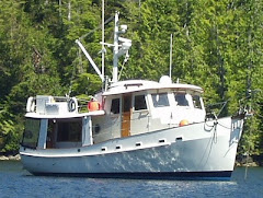
About noon Saturday we headed across River's Inlet to Duncanby Landing which has been in this location for decades. River's is s long time sport fisherman's "Mecca". Major salmon runs populate the several rivers entering the inlet. At one time there were 18 fish canneries scattered around here making this a major population center. They are all closed now as the wilderness slowly reclaims them. Over fishing certainly played a major role in the decline of the commercial fishing industry. But, there were other factors at play as well. Commercial air travel made the shipping of fresh and frozen fish feasible so people quickly lost their taste for the canned variety. Even at it's peak, most of Canada's canned salmon ended up in Great Britain and its colonies.
 |
| Apporach to Duncanby Landing |
Until recently Duncanby was a kind of rough place. The docks were in terrible shape but there was a small store and a bar where the locals from around the inlet hung out. But, in 2005 a guy with some spare change bought it and turned it into a high end fishing resort. The old cabins were replaced with nice new ones and the bar became a very good restaurant. Moorage is a little on the high side ($1.50/ft) and power is out of sight ($40/night for 30 A). We wanted to go to the restaurant but did not want to pay for power so we made sure we were fully charged up before arriving and just lived off our battery banks like at anchor.
Sunday, we move to a small nearby anchorage with the intent of going south around Cape Caution early Monday. EC was calling for smooth sailing and we were up at 05:30 Monday to listen - west wind 5-15 Kn, West Sea Otter 0.9 M and conditions at Egg Island were nice. So, we were off by 06:00 for a smooth trip around the Cape. The last third or the way the fog was pretty dense. In these conditions Rolynn is on radar watch for boats while my eyes are ahead looking out for timber in the water. We always know where we are within a couple of feet because of the GPS. It's the things we might hit, or hit us, that keep us alert. By noon we had pulled into Blunden Harbor, a well protected bay with room for nearly 100 boats. There were four counting ourselves.
Tuesday, we made the three hour trip to Wells Passage, the northern entrance to the Broughton Archipelago. We had hoped to make it to Jennis Bay Marina near the entrance of Drury Inlet for their Tuesday night Cajun feed but Stuart Narrows lays just inside the entrance and the timing for slack and dinner didn't work out. So, we anchored just around the corner in Carriden Bay. Tomorrow, we will go to Jennis for the night but, alas, no Cajun.
Jennis Bay lays about 30 minurtes inside Drury Inlet whose entrance is guarded by Stuart Narrows. Currents run to 7 Kn so passage has to be timed with slack water which is 15 min after slack at Alert Bay. Today, that was noon. Just inside the narrows is Helen Bay where there is a memorial to the men of the tug "Nanaimo". In 2001 the two man tug was found circling at full throttle inside the inlet with no one on board. The cause was never determined.
 |
| "Nanaimo"" Memorial - Drury Inlet |
We saw a shake barge on the way out on Thursday. The coastal red cedar is long gone but it is so valuable that there are operations which come into old logging sites and reclaim cedar stumps, etc. They cut them into standard lengths, helicopter them to the barge where they are packed onto pallets. When the barge is full it is taken to a shake mill.
 |
| Shake Barge in Drury Inlet |
Outside of Drury, we picked up the prawn pot. 60 big ones.
Good Morning Class - Put away your Ipods and cell phones, now. Sue, you're tardy. I need your admit slip - Thank you. Bonnie, please turn around. Rich, keep your hands to yourself. Mark, give Joel his hat back. Fran, put away your make-up, please. Thank you for your attention, Sandy, you are always my best student. OK, today's lesson is, "Why is the Water Deeper in Canada?".
There are places along the Washington/BC and Alaska/BC boarders that are covered by both US and Canadian charts. A close comparison of two charts for the same area shows that the water is "deeper" on the Canadian charts than on the US charts. And this has nothing to do with feet vs meters, etc. (Bridges are also higher in Canada.) How come?
The depths are based on a reference point called the chart's "Datum". To be safe the charts show the average least expected depth i.e. average low tide. But, in this part of the world the tidal pattern is called a "Mixed Diurnal". There are two high tides and two low tides each day (24 hours). One of the highs is higher than the other and one of the lows is lower. Like this:

So, which low tide to use for the chart's datum? In the US the datum is based on the average of both of the day's low tides or "Mean Low Water". But in Canada, the datum is the "Mean Lower Low Water" or the average of just the single lowest tide of the day. Thus, the Mean Lower Low Water is lower than the Mean Low Water so the water appears deeper in Canada.
There will be a quiz in the next blog.
We will poke around the Broughtons for the next ten days, or so. We plan to hook up with our California friends, the Minors, aboard "Seeker" who will be in the area as well as visit our customary haunts. We will move down Johnstone Straits around the 17th with the intent of meeting up with some of Rolynn's old teaching friends from Jaunita HS in the Octopus Islands. They are chartering a boat for a week.

I will not take "the quiz"! Good to read your update! My best, Barbara
ReplyDeleteThe Coastal Red Cedar is far from long gone.
ReplyDeleteShake cutting operators do not cut leftover stumps. They cut the old blowdown and logs left behind from the handlogging days. Cedar is so resilient to rot, that a tree that blew over more than 100 years ago can be made into a merchantable product.
Also, it is Wuikiniuxv, not Qweekena.
other than this it was a good read.
Thanks for a clearer explanation of shake cutting than my blog space allows. I realize that there is still red cedar but certainly to a much lessor extent than former days.
DeleteAlso, "The Wuikinuxv people, also known as the Wuikenukv, Oweekena, Wikeno, Owikeno, Oowekeeno, Oweekano, Awikenox...."