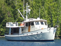
Skagway (June 27-29): We decided not to take the boat to Skagway. It is a long way up Lynn Canal to Skagway, about 70 miles each way. We would face at least two ebb tides, probably four. The canal runs north-south so if there is any south wind against an ebb tide the canal will turn snotty in a hurry - and there are very few places to hide. With as many as four ebbs the chances are too good (bad) that we would face unpleasant conditions. So, we scrambled to get ferry tickets, hotel reservations and White Pass train tickets and took a three day (instead of five in the boat) trip to Skagway.
We walked on the ferry at 06:00 and grabbed front row seats in the observations lounge for the seven hour trip up the canal. It was a beautiful day. We read, dozed, watched, worked, and listened to the on-board park ranger give his talks. It was very enjoyable. After we checked in to one of the tree hotels in Skagway (a B&B) we walked the boardwalks of town. Much of down town is actually owned by the National Park and they have a good museum about the 1898 Yukon gold rush. There was a world wide depression, the Panic of 1893, when gold was discovered on the Yukon River in the Canadian Klondike. More than 100,000 people rushed to the area. Doctors, lawyers and merchants as well as bums (like Jack London) flooded north. The mayor of Seattle resigned his office, in route. When they got here they were dismayed to learn that they still had 600 miles to go, much of it over either of two high mountain passes. Worried about a disaster, the Canadian Mounties established a check point at the summit - the boarder. They required each person to have at least 2000 pounds of supplies. So, the wealthy hired the local Tlingit to pack their supplies - at $1.00 per pound. The not so rich made 20-30 trips, single file, up steps carved in the ice to the summit. The other route was suitable for pack animals. Enterprising persons down south sent broken down horses to Skageway for top dollar rather than to the knackers. The horses promptly died on the pass. One location made famous by Jack London became known as Dead Horse Gulch. The spring revealed over 3000 carcasses. I've seen the pictures. After the summit they had to pack it all to Bennett Lake where they spent the winter building boats. When the ice broke up on the Yukon River they raced down the rapids to the gold fields only to find that all the claims had already been taken. The rush lasted only a year and only few got rich, and most of them were the folks who sold the miners their supplies or stole their money, like Soapy Smith.
White Pass Train
 A few years after the rush a narrow gage railroad was built over the pass to Whitehorse. The train still operates and it is a dramatic trip up to the summit and back. The weather wasn't great but we had a good time. The following day we returned, via the ferry, to Juneau.
Upon our return to Auke Bay I discovered that my laptop had died. It would not power up. No lights, hums, blinks - nothing. That means that I can not access any data on the hard drive. Inquiries revealed that the power circuits in the motherboard are probably TU. So, the next day I took the bus to Costco to go computer shopping. I spent the remainder of that day and all of the next installing critical apps and downloading stuff. I got to a place that I can live with. When we return to Anacortes I will get a housing for my old hard drive so that I can retrieve my data.
Sunday morning we filled up on fuel (422 gallons at $4.29 per gallon. Do the math.) and took off for Glacier Bay.
July 2 - Auke Bay to Glacier Bay: We had planned to stop about half way to Glacier Bay but we didn't like the anchorage so we called the park and asked permission to come a day early. We had to ask because the National Park Service has strict regulations about entry into the bay. You have to have an advance permit. The park is the size of Connecticut but they only allow 25 boats, including cruise ships, in the bay at any given time and seven days is the maximum stay. That means there are only 3-4 new entries per day. Our permit started on the third so we had to ask permission to enter on the second. Fortunately, there was a cancellation so we were able to enter and anchor off the park docks. The following morning we attended the required orientation session where we were apprised of the various rules and area closures, all aimed at protecting the abundant wild life. The speed limit is 13 knots (Not a problem for us.) and we can not come within a mile of the shore if the channel is more than two miles wide. If it is less then we take a mid channel course. When approaching an anchorage we do so at 90 degrees. All of this is because of the humpback whales which are like mosquitoes here. They migrate here with their calves from Hawaii and Mexico to feed, which they do along the shore. They are sensitive to the noise of boats so keeping us slow and off shore is to their benefit. We must stay at least 0.25 miles away from them but they sometimes pop up closer. There are similar rules concerning the other marine mammals and birds.
Glacier Bay (the park is much bigger than the bay) is about 70 miles long and it is about 60 miles from the entrance to the northern most glaciers. When Captain Vancouver came by in 1794 the glaciers extended out into Icy Straits. When John Muir was here in 1879 he found the ice 40 miles up bay from Vancouver's charting. The maximum advance was around 1750, the end of the "Little Ice Age" which had lasted about 400 years. Now, only one of the glaciers is advancing. The others are either stable or retreating. This is big country. The Fairweather Mountains which comprise the peninsula that form the western side of Glacier Bay, have at least 18 peaks in excess of 10,000 feet with 6 over 12,000 including Mt. Fairweather at 15320 feet.
Fighting Bears - Blue Mouse Cove
 Sunday - We anchored the first night in Blue Mouse Cove. 120 years ago we would have been under the ice. Around dinner time a Humpback and her calf entered the cove and made a couple of tours. The cove is relatively shallow so they stayed near the surface. The first time by they came within forty feet of the boat. The second time them came right at us then dived under the boat and came up on the other side. We tried to get pictures but they don't show much of themselves and you never know where they are going to surface. A little later two brown bears showed op on the beach. They soon approached each other and got into a scuffle. They got on their hind legs and boxed and growled. There were three rounds of action, each separated by periods of cautious rest. The second round took place in the water. By the third round they were like to heavy-weight Greco Roman wrestlers who knew each other's moves too well. In the end the larger won on a stalling call. Afterwards, they ambled off into the woods, side by side. I think they went to reminisce about old bouts and have a beer or two. Later, a park ranger said they were probably sibblings. Around midnight we heard a pack of wolves howling.
Reid Glacier
 Monday, the Fourth of July, we are anchored in Reid Inlet about 1000 feet in front of our personal glacier. It is a terrestrial glacier (just barely) so it doesn't calve ice bergs into the water. We grilled steaks for dinner.
We awoke to low overcast and steady drizzle so we decided to stay put for a second day. Rolynn has a cold which she caught from me which I probably caught on the bus to Costco. We can't get any weather broadcasts up bay but the last weather forecast we got two days ago called for no rain tomorrow, the 6th, and we'd like a nice day to go Margerie Glacier. Besides, the same report predicts some wind and 4-5 foot seas in Cross Sound so we want to drag our feet a little and let that pass before we exit the bay.
 "She's alive! She's alive , I tell you!" (Mel Brooks - Young Frankenstein)
Wednesday morning we awoke to mostly sunny skies as headed up Tarr Inlet to Margerie Glacier. Margerie is the most active of the glaciers in the bay, meaning large pieces of ice break off the face and fall crashing into the bay. We watched a cruise ship go in ahead of us and let her clear a path through the floating ice for us. As she vacated her parking spot in front of the glacier we took her place. She had swept a nice vantage point clear of ice. The sky was clear and there was not a whisper of wind. We drifted at about a half mile from the face and didn't move twenty feet in two hours. We are at 59o 03' N, the most northerly point of our journey and only a mile from the Canadian border. Margerie rises about 250 feet above the water with another 100 feet below. She is about a mile across the face and 21 miles long.
Margerie Glacier
 It is like a living thing. It crawls forward about 6-8 feet a day. She is almost constantly make growling sounds. Every few minutes we hear what you would think are riffle shots or shotgun blasts in another setting. Some sound like dynamite. Every 10 minutes, or so, we first see, then hear, a house size chunk of ice plummet into the bay. The sound is awesome as the echoes reverberate between the mountain sides. I don't know anywhere in the world where one could duplicate the experience.
At 14:00 we pulled away and picked our way back through the bergie bits and headed for Russell Island for the night. The anchorage is a little open but the winds are calm and the barometer is rising so we think we will be OK here. If the wind comes up we can head around the corner and back to Reid Inlet only about 30 minutes away. That's the nice thing about being this far north. Even if we have to move at 02:00 there is still light.
Wednesday was a quiet night so we moved down bay to North Sandy Cove. Access to the shore here is prohibited because the bears have become too familiar with humans. We thought this might mean we would see tem along the shore but we saw only a small black bear in the distance. We left in the early Friday afternoon for Bartlett Cove where we took on water and anchored off the dock for the night.
Seine Boat in Icy Straits
 The ABC Islands: We checked out from the park Saturday morning and headed west into Cross Sound towards the Gulf of Alaska. We are now heading into the ABC Islands, Admiralty, Baranof and Cichagof Islands. The trollers were out fishing and we saw humpback whales spouting and flashing their tails in every direction. There were so many that we could smell their breath down wind. One breached completely clear of the water about 500 yards in front of us. Later, we heard that a humpie had breached under a sailboat near Hoonah and broke the boat in two. The boaters were pulled out by fishermen. The boat was probably sailing without engines so the whale did not know it was there. Its best to make some noise. Leaving the depth sounder on is a good idea if you are not motoring. We also read an account of a boat from Sitka that was sunk at anchor by a whale while the owners were off in their dinghy. No one believed him until they found baleen stuck in a three foot hole in the hull.
We turned the corner into Lisianski Inlet and tied up at Pelican about 15:00. We had heard of Pelican for years - it is a boardwalk town, no streets. It is located at the edge of the Gulf if Alaska and its rich fishing grounds so Pelican had been the base of the local fishing fleet. Then, a few years ago the fish plant closed down and the fleet moved on. Now, most of the fishing boats in the harbor appear to be derelicts. It is sad. The town is slowly dying and the locals can't agree on how to adapt. We saw one sign on a house door, "I'd rather have a daughter in a whorehouse than a son on a cruise ship." We were disappointed in Pelican.
From Pelican we have the choice of heading west through Lisianski Passage then down the Pacific side of Chichagof and Baranoff Islands to Sitka or go back up Lisianski Inlet and circumnavigate Chichagof counter clockwise, staying out of the Pacific. We chose the later so we made the short run to Elfin Cove, another one of those places we have wanted to visit for years.
Elfin Cove Highway
 Elfin Cove is even smaller than Pelican, 18 people last winter according to the postmaster, but it is doing better. It never depended on a fish plant so it is adapting. There are several fishing lodges here which seem to do an active business. There is also a post office, a surprisingly well stocked store and a decent restaurant. This, too, is a boardwalk town. The only vehicles are hand carts. The "main" boardwalk is actually an Alaskan highway and is maintained by the state. The walks and trails meander all over the cove. It is really quite charming. If you squint a little you might see Hobbits peaking from among the ferns. Like many of these small towns, Elfin began as a winter harbor for bachelor fishermen who lived on their boats. The winters are milder here, close to the Pacific, than they are at the mainland.
Fairweather Mountains from Elfin Cove
 The weather has been spectacular here but they are calling for some wind so we will want and see about leaving tomorrow. "They" is the US Weather Service who's predictions are not very useful. They have a limited repertoire: Winds 10 knots, Seas 2 feet or less; Winds 15 knots, Seas 3 feet; Winds 20 knots, Seas 4 feet, Winds 25 knots, Seas 5 feet; etc. We have yet to see actual conditions anything like their predictions. It seems like they just want to be in a position to say, "We told you so." if you go out and get hammered. By "seas" they mean "Significant Wave Height (SWH)" - the average height of the highest 1/3 of the waves. So, a 6 foot sea is the average of the highest waves, some being higher. More precisely, 1 in one 1000 waves will be twice as high as the SWH. (This happens when two waves get in phase and double their amplitude.) So, if a wave comes by every 5 seconds in a 6 foot sea you will see a 12 foot wave within a couple of hours. So, pay attention out there.
Rolynn has done yeoman's (yoewoman's?) duty for parts of two days cleaning and reorganizing the engine room. She's done a great job that we have put off for a couple of years.
Downtown Elfin Cove
 Last evening a large ship anchored nearby. She has a military or research vessel look to her - lots of cranes, a huge radar dome, helicopter, boats on deck, etc. She has a submarine, too. It turns out that she was built as a resherch vessel for Jacques Custeau but was sold to a hedge find mogul a few years ago who refitted her (5 years!) for his personal use. He is cruising around now with his friends aboard. His crew includes private fishing guides, naturalists, pilots, etc. When he is not using it he leases her out to governments, research institutes, etc. Last summer she was leased to the French government. They used her to find the Air France flight that went down in the Atlantic.
On the Tide Grid in Hoonah
 Hoonah - July 13: A five hour cruise in modest seas brought us to Hoonah on the NE corner of Chichagof Island. It is the largest Tlinget community in SE. These Huna trace their history back 3000 years to Glacier Bay when they were forced to vacate that place due to the advancing glaciers.
The old cannery about two miles from town has been converted into a destination for cruise ships that sit across the bay and ferry in their passengers on life boats. So, we made the hike to Cannery Point. There is an interesting museum which shows the canning process as well as shops and eateries of various kinds. There are couple of examples of the "Iron Chink" which is a large mechanical wheel that cleaned the salmon. It replaced the Chinese workers who had been doing the work by hand on the "slime line". Its interesting that they never explain the origin of the name. Not PC, I guess. Also at the cannery is a mile long zip line that begins at the top of the mountain. It is actually five lines abreast. A rider its 60 mph on the way down. 92 seconds for $92. We passed.
When Alaska was federal territory the natives of the Hoochinoo tribe learned to make bootleg. They used steel drums to heat the mash and instead of copper coils to cool the vapor they used the hollow tubes from the stalks of bull kelp. That's the derivation of "hooch", among others.
In 1944 two women were smoking salmon under a house resulting in a fire which spread to the neighboring houses. It was also common practice then to store gasoline in barrels under houses. You can guess the rest. The fire spread in a series of explosions that destroyed the town. The chief of the clan to whom the women belonged realized his clan could never repay the damages so he gathered the clan's regalia (most prized ancestral possessions) around him and let the fire engulf him to pay the clan's debt.
We had debated about stopping at Hoonah but it was worth the stop.
Tenakee Springs Post Office
 Wednesday and Thursday - Tenakee Springs: Tenakee is a metropolis - if had almost 70 residents last winter. There is a store, Snyder's Mercantile, that opened in 1899 and a little café. This too began as a winter harbor and it has the added attraction of a hot springs in the middle of town. (There are men's and women's hours - no clothes allowed.) Many of the summer residents are retired public employees from Juneau. Others just want to be left alone. In the café I chatted with a guy doing beading. He was a ringer for Jerry Garcia of the "Grateful Dead".
The Tennakee Mall - Snyder Mercantile

 Friday morning we left for Appleton Cove at the entrance of Peril Straits, the main "highway" to Sitka. We will have to time the rapids at Sergius Narrows but it looks like we can get all the way to Sitka in one day.
In transit we were overtaken by the Fairweather, the fast ferry. It is a BIG catamaran (twin) hull with water jet propulsion. Her AIS (a system that broadcasts a boat's location, heading, speed, etc) showed her at 38.2 knots, almost 45 mph. We got out of the way! We meet her again in Neva Strait as she was leaving Sitka. There wasn't much room for us to move to the side but she was only going at 18 knots because of the narrow channel.
We arrived in Sitka around 16:30. Krogen friends, Norm and Pat Wade, who reside here in the summer, met us at the dock and we had a nice chat. We walked toward town and made reservations at Ludwig's for Rolynn's Birthday dinner but we had fish and chips elsewhere.
Monday - Today was devoted to boat jobs. It's raining so we might as well. I changed oil (five gallons) and filters. We've put on 235 engine hours since we left Anacortes, the equivalent of about 10,000 auto miles, so its time. There is an oil recycle dump at the top of the dock ramp. Unusually convenient. Rolynn worked on her latest novel and also the marketing of "Last Resort". She had a calamity a couple of days ago. Even though she backs up she lost a week's worth of work on her present book. We also made a trip to the grocery store in the rain.
Sitka - Totem Pole Park

 Sitka is a derivation of the native name "Shee Atika" - the people who live on the side of Shee (Baranof Island). The Tlingits who lived here were a prosperous people because of the many food sources available. Also, the Japan Current runs off shore which keeps the harbor ice free year around so the natives weren't forced relocate seasonally. These factors allowed for a stable population and the free time to commit to art and crafts. Baranof was the manager of the Russia-America Company. He talked the Czar into giving his company exclusive trading rights based, mostly, around sea otter furs. He built a post here (ice free) in 1799, hence the Russian heritage of the area. There are about 8000 residents now and about as many commercial fishing boats, it appears.

Wow, great descriptions and pictures - perfect for those of us that will never make a trip like yours!! Sounds like a lot of hard work with many rewards. The food alone must be fabulous! You didn't mention wine?? Thanks for keeping us updated,
ReplyDeleteMarta and Bob
The brown bear wrestling match reminds me of one Kotter & I witnessed in Ferndale--an "Over The Hill" match. Two heavyweights (one who had just defeated the PAC-10 Champion) waltzed around the mat for what seemed forever in a stall-exhibition not witnessed by mortal man since. Seems as if they both knew each other's moves and so the counter-moves went on ad infinitum, finally resulting in the observers dropping into quiet slumber and Steve winning the first place medal and not being able to walk for a week. Ahh, for the good old days!
ReplyDelete