Note: We have a new feature this year. By accessing http://tinyurl.com/3mhj7gz you can see our cruise to Alaska in real time. Our SPOT device leaves a position report every ten minutes while we are under way. Along as I remember to reactivate it each day, that is.
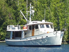
Friday, May 13 - Departure: We have been busy the previous ten days preparing for departure and installing the DIY water maker (Desalinates). The later took longer than planed which is to say that I should have planed for it to take longer. In addition, the motor required to run it appears to be faulty and its replacement did not get here until Friday AM. The place I bought it from paid $140 to send a replacement from New Jersey via next day UPS and said not to worry about returning the original until we get back in September. Pretty good service. We had planed to fly back to Seattle from Petersburg on June 10 for the Hall of Fame induction but since we are late getting started we changed the tickets to Ketchikan. That gives us a little more leeway since it will take three weeks to get there without allowing for weather delays. Anyway we pulled out around 10:30 AM and headed for Montegue Harbor on Galiano Island, BC where we cleared customs and spent the night.
Saturday, May 14 - Nanaimo: The next day we timed our arrival at Dodd Narrows for the 14:45 slack and dropped anchor behind Newcastle Island across from Nanaimo by 15:30. Environment Canada’s predicts calm winds tomorrow so we may go straight up the Straits of Georgia to Desolation Sound. That would save a day.
Sunday, May 15 – Georgia Straits: We were up at 04:30 to listen to the condition reports from the lighthouses and buoys. Looks good so we got under way at first light for the twelve-hour trip up the straits to Squirrel Cove on Cortes Island in Desolation Sound.
Monday, May 16 – The Rapids: Today we have to “climb” the rapids through the network of islands that comprise this region. The tidal currents can reach 15 knots or more and we are a seven-knot boat. You see the problem. You can see the current graph for the Yuculta Rapids on our day of transit below. You might be able to see that the time for safe transit is less than 30 minutes. We timed our transit of Yuculta Rapids for the 10:00 slack and made our way around The Devil’s Hole by taking Tugboat Pass behind Little Dent Island. We held up at Shoal Bay while we waited for the PM slack at Shell Point Rapids. We were tied up at the dock at Blind Channel Resort by 16:30. There was only one other boat there. The resort has been here since the 60s. It was begun by a German immigrant and his wife. She died a couple of years ago but he still lives here year around along with his son’s and grandson’s families as well as two great grandchildren. There is an excellent restaurant here but it is not open yet. The weather report calls for light winds in Johnstone Straits so we may exit Blind Channel via Mayne Channel into Johnstone Straits.
Tuesday, May 17 – The Straits: As called for, the wind in Johnstone Straits was only 4 knots at Fanney Island at 06:35. That’s unusual even for the morning. The tide is ebbing NW (in our direction of travel) so we left at 08:00. That gave us a good push of 1-3 knots up the straits for the four-hour trip to Havanah Channel where we exit the straits. The wind was calm and the water pretty flat. However, there was more timber in the water than we have ever seen. Lots of snow melt and high tides means that a lot of wood gets washed into the water. We had to proceed at dead slow several times to pick our way through the stuff. There were miles of it.
Again, we had to wait for the slack at Chatham Channel before proceeding to the dock at Lagoon Cove for the night. As we started up outside of Chatham Channel I noticed that the rudder indicator showed the rudder hard to starboard no matter its actual position. Investigation at Lagoon Cove revealed a loose nut where the rudder position sender attaches to the rudder arm. Easy fix. Wish they all were so easy. We were the only boat at the docks. We made gin and tonics for Bill, the owner, and his caretakers Pat and Bob chatted with them on the deck of the “historic” machine shop. Over the next few days we will visit friends in the Broughton Archipelago before setting up to move around Cape Caution.
Wednesday, May 18 – Pierre’s: The weather outlook looks good for going around Cape Caution on Friday. So, we decided to go straight to Pierre’s at Echo Bay today then to Allison Harbor on Thursday. That sets us up to go around on Friday. Here’s an overview of the area.

Leaving Echo Bay
Friday, May 19 – Queen Charolotte Straits: Sky was blue and it was 38 when we left Pierre’s at 08:30 for a six hour run in flat seas to Allison Harbor. We saw only two other pleasure boats on the water. There was no traffic on the radio eother.
We are anchored just south of big inlets named Seymour and Belize. That’s a lot of water in there, especially at high tide. There is a narrow outlet named Slingsby Channel through which all that water must pass. On big tides, like now, it comes out like a fire hose. At the narrowest place, Nokwatko Rapids, the current can reach 20 knots, among the fastest in the world! If the wind is opposing it can get REALLY rough there. We will give it a wide berth.
There is an automated sea conditions buoy well off shore named West Sea Otter. The rule of thumb is to wait for the seas to be at 1.0 meter or less before going around Cape Caution. We also need to think about the tides. Rivers Inlet is a huge body of water just north of Cape Caution. As the name implies, lots of rivers enter the inlet. That flow is especially big in the springtime. The spring is also when the biggest tides of the year occur. (That’s why the biggest tides of each month are also called spring tides.) During ebb tides all that water flows east out of Rivers Inlet into Queen Charlotte Sound. If there is a west wind it pushes the out-flowing water into waves. This is the classic “wind against tide” scenario which results in close, steep waves. They are sometimes called “square waves” because they are as high as they are far apart. The best time to cross Cape Caution, or similar areas, is on a flood tide with little wind. Tomorrow the prediction is for a big ebb tide starting about 10:00 but the winds will be only NW 5-15 knots. It’s a five hours crossing so, if West Sea Otter is less than 1.0 meter and the winds are indeed light we will leave about 07:00. That will put us beyond Rivers Inlet before the tide turns to ebb.

Queen Charolotte Sound – Straight Ahead for Alaska, Turn Left for Russia
Friday, May 20 – Cape Caution: We broke the rule a little bit. West Sea Otter was 1.8 meters at 04:40 but by 06:40 it had dropped to 1.6 and it was at 1.5 by 07:40. Meanwhile there was minimal wind at Egg Island and the conditions there were a “one foot chop with a low NE swell”. It look like it was the best we could ask for the next few days so the Environmental Compliance Officer (Rolynn) made the call to pull up the anchor at 08:20. There was no wind and the low swell just about put us to sleep. Only dodging the logs kept us awake. About an hour outside of our destination we spotted a hump back whale cruising across our bow and by 13:00 we were at anchor in Fury Cove at the mouth of Fitz Hugh Sound with six other boats including “Hey You” from our marina.

Fury Cove on Penrose Island
Saturday/Sunday, May 21-22 – Shearwater: We woke up to drizzle and calm wind Saturday morning. We had originally thought to only go as far as Goldstream Harbor today, just 2.5 hours up Fitz Hugh Sound, then on to Shearwater, near Bella Bella, the next day. But we could either sit in the drizzle or make progress in the drizzle so we just went on to Shearwater, arriving at 17:00. We met Bill and Joy of “patience” on the dock and joined them for dinner at the not too bad restaurant here. A glance at the charts makes you think that here are lots of ways north from hear. But a closer look tells you that every path leads to a dead-end except one and that’s through Shearwater. It is the choke point of the Inside Passage – all boats go through here. It is the only marine yard between Port Hardy (at the north end of Vancouver Is.) and Prince Rupert at the CN/AK border. There is also a fishing lodge, marine store, pub/restaurant, and store. During WWII this was a seaplane base for the Canadian Navy. The cavernous marine shop was the hanger then. Many of the islands hear abouts were named then by the pilots for planes used in the Battle of Briton – Hurricane, Spider, Spitfire, Stryker….
The locals tell us there was a big storm here about three months ago. 100+ knot winds sprang out of nowhere and hit the marina at –15:06 in the afternoon. They described it as a wall of water coming across the bay. It tore out the docks and did a lot of other damage. The docks were just recently put back in but there is no water and only limited power, for now.
Other local news, for those that have been here. The owner acquired a brand new fishing lodge on a barge from an outfit that had gone bust. It is VERY nice. Has about 20 rooms. They prepared a platform on the shore at low tide then floated in the barge at high tide, let is settle and then built up stone rip rap around it to secure it. He got it for only $200k. A steal.
One gets wifi here by purchasing a 24 hr password from the store, but the store is closed until Tuesday, Monday being Victoria Day. But, Rolynn charmed the young waitress in the restaurant so she gave Rolynn her private access code to use while she is on duty. So, Rolynn is busy arranging to have her new book shipped to friends in Seattle where we can pick them up when we are in town. I hope to post this blog from here as well. If all goes well I will post again from Ketchikan around June 1st.
 Dyad Point Lighthouse
Monday, May 23 - Bottleneck: We left Shearwater this AM without being able to post this blog so it will have to wait until we get to Ketchikan. We have about 120 out of 240 gallons of water in our tanks but we stopped at the fuel dock in Bella Bella to top off but it was closed for Victoria Day. We will pass Klemtu today, another First Nation village but it too will be closed. We have enough water to get to Hartley Bay, yet another FN village, so we are not worried.
Only scattered clouds and sun today, about 60o. And, again, no wind. No one can remember a better, longer lasting weather window this time of year. Especially after it has been co cold and nasty up and down the coast this winter. But, we have our little diesel fireplace going and we are toasty warm. We even have to open a door at times to avoid overheating ourselves. We cruised along for almost seven hours listening to an audiobook and saw only one other pleasure boat.
We arrived at picturesque Bottleneck Inlet on Finlaysen Channel at about 15:30. After dropping the anchor Rolynn turned on the tap in the galley. No water!!. We checked the meter and it showed we have used all 240 gallons. It read 160 when we left the dock at Shearwater. No faucets were on so we must have a leak in the engine room water line somewhere after the pump. (We could not hear the pump running over the noise of the main engine.) We can’t find the leak because there is no water in the system to leak. So, it will be an eight hour run to Hartley Bay tomorrow where we will fill up. (We have enough to brush our teeth with, etc.) Then we can look for the leak. We figure it was loosing about 15 gallons an hour so it should be easy to find.
Tuesday, May 24 – Hartley Bay: Up anchor at 07:30 for the eight hour run to Hartley Bay. Uneventful. Flat water, no wind, high overcast clearing to blue skies by 15:00. Listened to Robert Parker’s Death in Paradise, an early Jesse Stone novel. Good author, good story. Filled up on water at Hartley then moved around the corner to the Couglan Anchorage in Stewart Channel for the night. Found the source of the water loss. Hose clamp had failed allowing water to pump into the bilge and then overboard. Easy to get to location, quick fix. Resulted in new procedure, though. We will turn pump off over night, underway or at other times we can’t hear it run. We are well ahead of schedule so we will take three days in Greenville Channel. Will stop at Lowe Inlet tomorrow and Baker Inlet the next. Two days after that we will be in K’kan.

Hartley Bay
Wednesday-Friday, May 25-27 – “The Ditch” Greenville Channel, AKA “The Ditch” is 45 miles long and less than a mile wide in most places. Averaging about 600 feet deep, it has high, steep mountains on both sides. Very pretty. It is also the I-5 of the Inside Passage. All the cruise ships, ferries, tugs and barges access SE Alaska via this route. Since we are killing a little time we take parts of three days moving through. Tonight we stayed in pretty Lowe Inlet with five other boats. Today we will go three hours to Baker Inlet. We must enter it through Watts Narrows which can have strong currents so we will time our departure from Lowe to arrive at Watts at about 16:30, the approximate time of slack. I say “approximate” because there are no current tables for Watts. The time of slacks is about the time of high/low water at Prince Rupert. We will overnight in Baker then exit Greenville for Hunt’s Inlet at the north end of Porcher Island.

Saw a good sized black bear on the beach this AM. He was rolling rocks looking for breakfast. We had leisurely morning and then departed for Baker Inlet but there is a low overcast and a steady drizzle. Dolphins played in our bow wake for a while. We decided there was no point in fooling with Watts if we couldn't see much anyway so kept on for another hour to Kumealon Inlet. That puts us a little further upstream for tomorrow. It will be only 3.5 hours to Hunts Inlet.
Friday - 540 04’ North – This is the farthest north we have been on “Intrepid” so far. The boat has been farther but not with us on board. We are in Hunts Inlet at the north end of Porcher Island, about 15 miles Southwest of Prince Rupert, BC. From here we have two basic choices to get to Ketchikan. It is about 13-14 hours to K’kan from here, too far for us in one day so we will split it in two. But, the US-CAN boarder is between here and there and once we cross it we can not touch bottom or shore without first clearing US Customs and Immigration in Ketchikan. But, with prior permission we can pull up short of Ketchikan and anchor in Foggy Bay, AK. It is about eight hours to Foggy Bay and another five to K’kan. Or, we can go seven hours to Wales Harbor on the south side of Pearce Canal and overnight there. It is in Canada but just barely. The boarder goes right down the middle of the canal and Wales Harbor is on the Canada side. From there we can go another seven hours straight to Ketchikan without having to fool with Foggy Bay. We will listen to the weather tonight and again early tomorrow and then make up our minds.
Satsurday/Sunday - Dixon Entrance and Ketchikan: Up at 05:00 to listen to the weather. Sounds good so up anchor at 05:30 for a 7 hour run to Wales Harbor on Wales Island near Portland Canal. Flat seas the whole way. Wales is small - two boats max but very protected and pretty. Had a nice afternoon and evening. Watched a DVD.
Up early for weather and pulled up at 05:30 for a eight hour run across Dixon Entrance to Ketchikan. Good water except for an hour or two in Dixon - a little roll but it flattened out as soon as we turned the corner from Dixon into Revillagigedo Channel. Tied up at K'kan by 14:00, cleared customs and walked through town. Four cruise ships here today, five tomorrow. Had dinner at Annabel's. Pretty good chowder.

Congratulations on making it to Ketchikan! I wondered about that last leg and what the seas would be--smooth or nasty. Looks like you got smooth.
ReplyDeleteReading this makes me wish we could have figured out a way to meet up somewhere in Alaska. Are you going all the way to Glacier Bay?
ReplyDeleteThat's the plan. Weather pending.
ReplyDeleteEnjoyed your blog - makes me envious. When you are in Ketchikan, if the Foc'sle Bar is still there, I would be curious if they still have the large picture over the bar of the M/V Martle laying on her beam's end on Hog rocks. (Yours truly was one of the passengers) We hope everything continues to go well for you on your journey! Clark & Ervine
ReplyDelete